

Installations
google - be internet awesome adventure, 2019
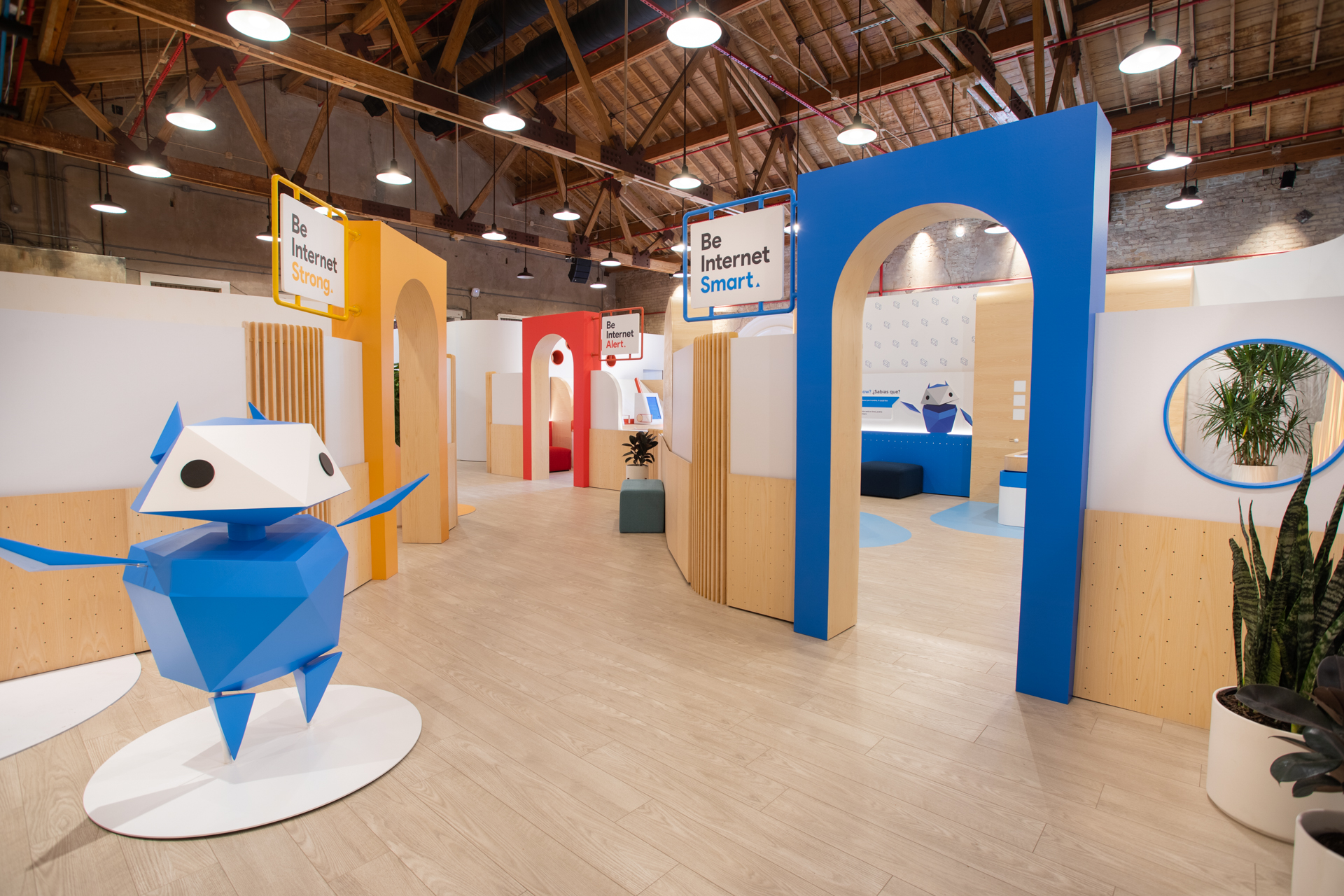
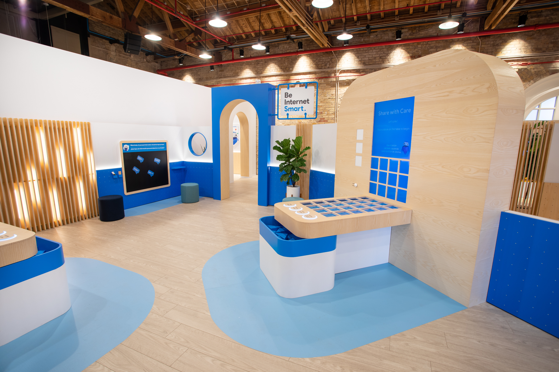
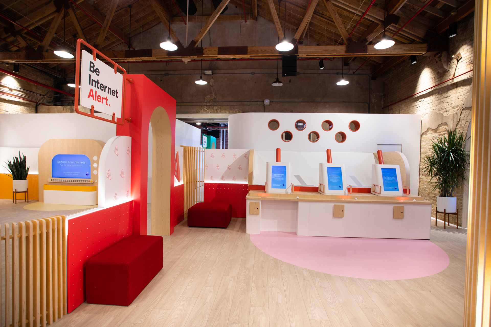
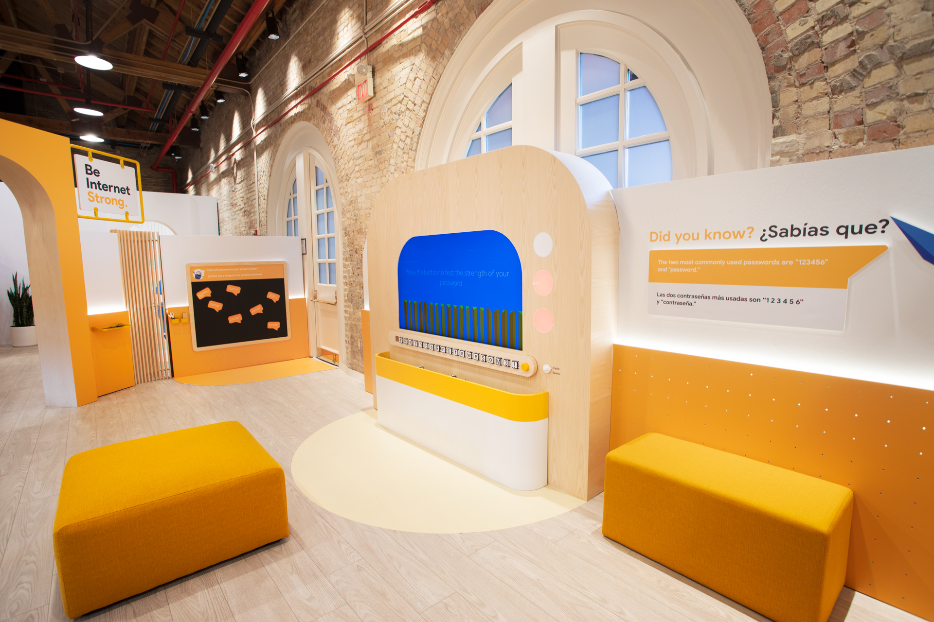
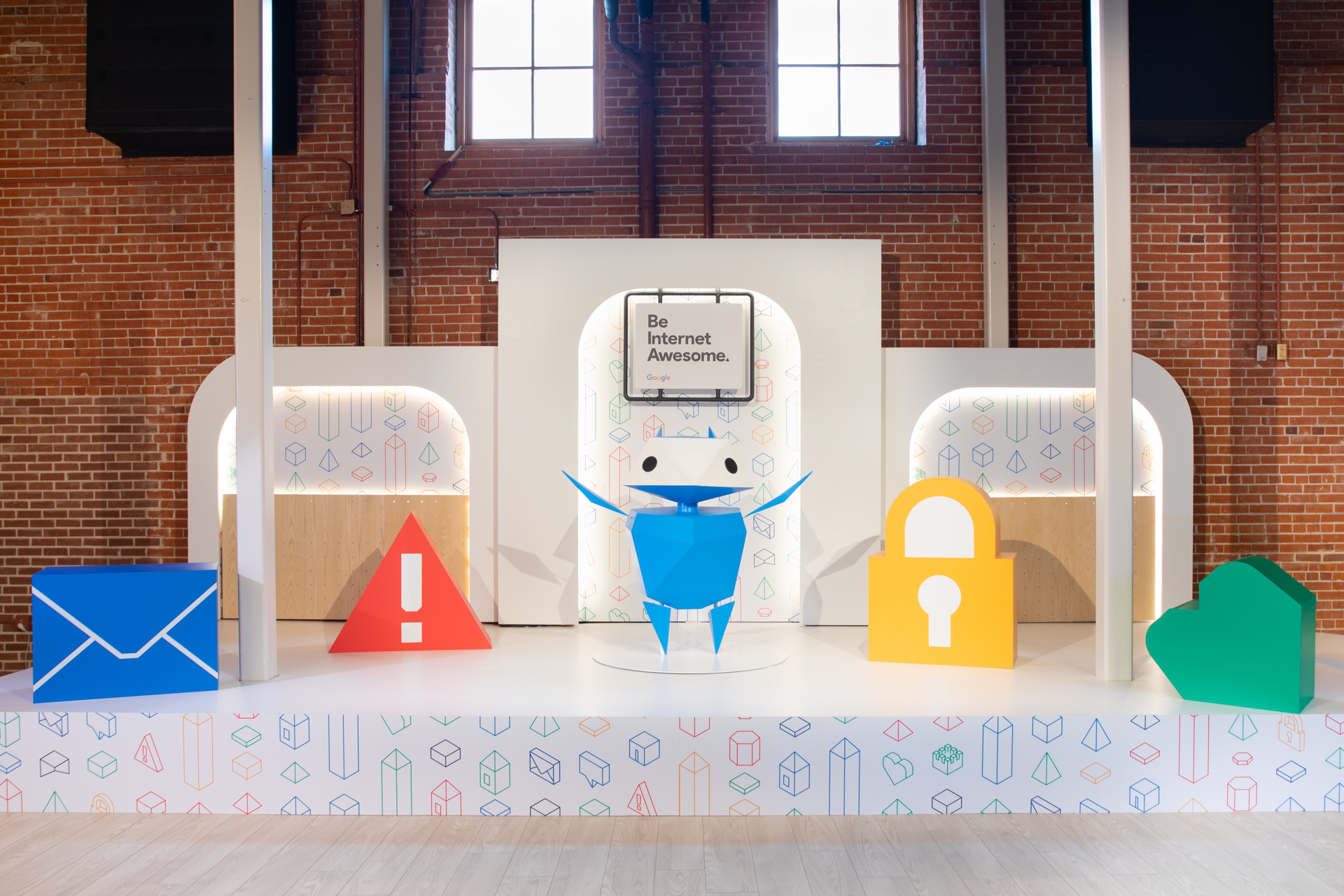
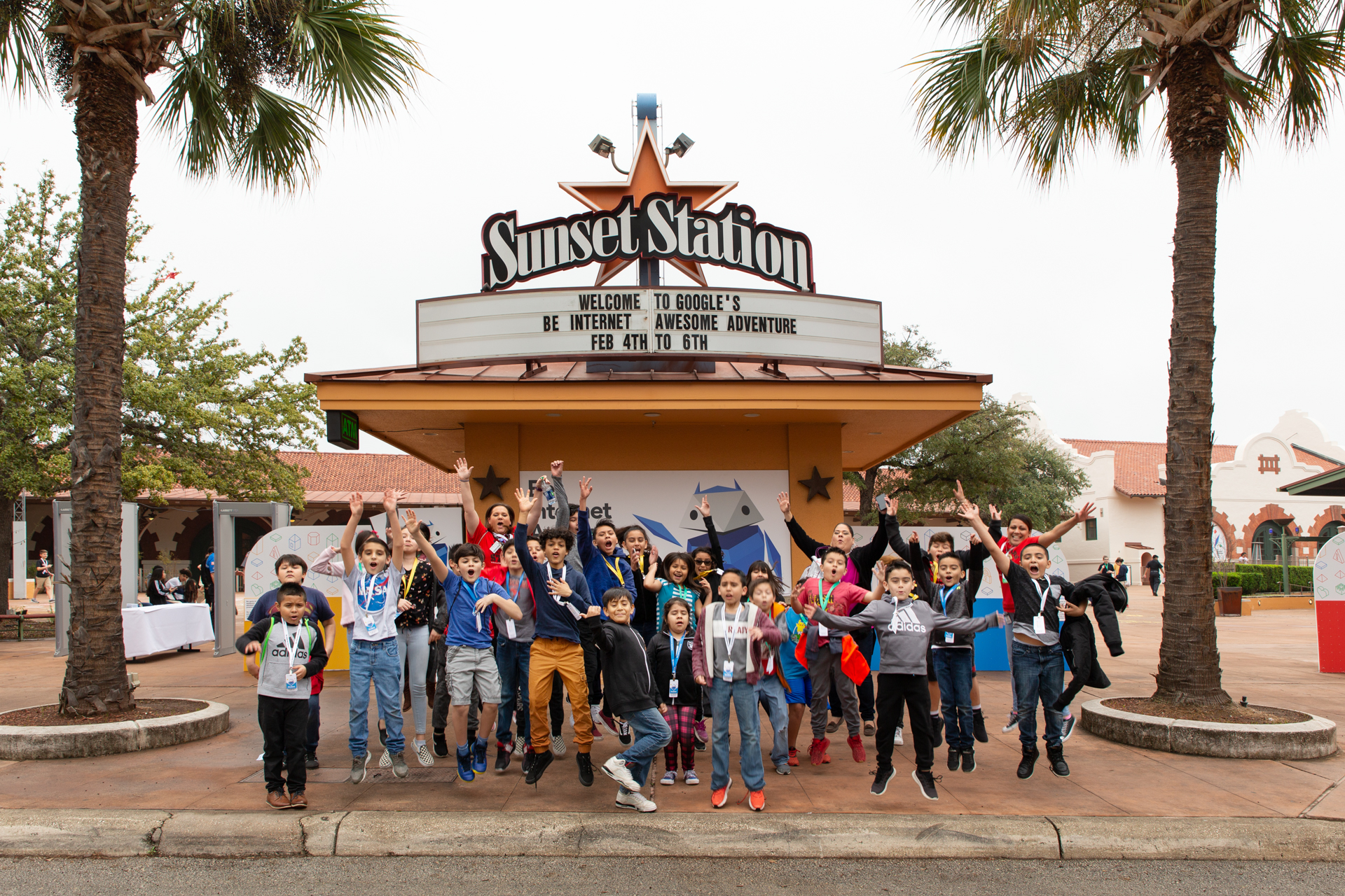
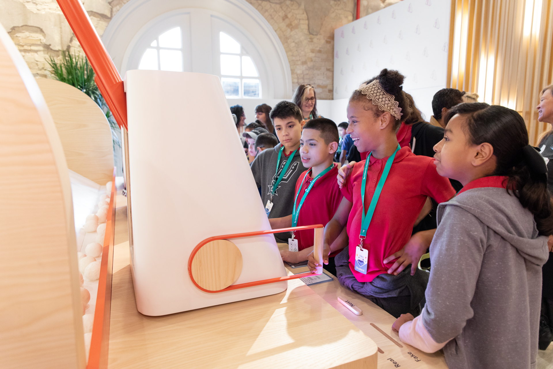

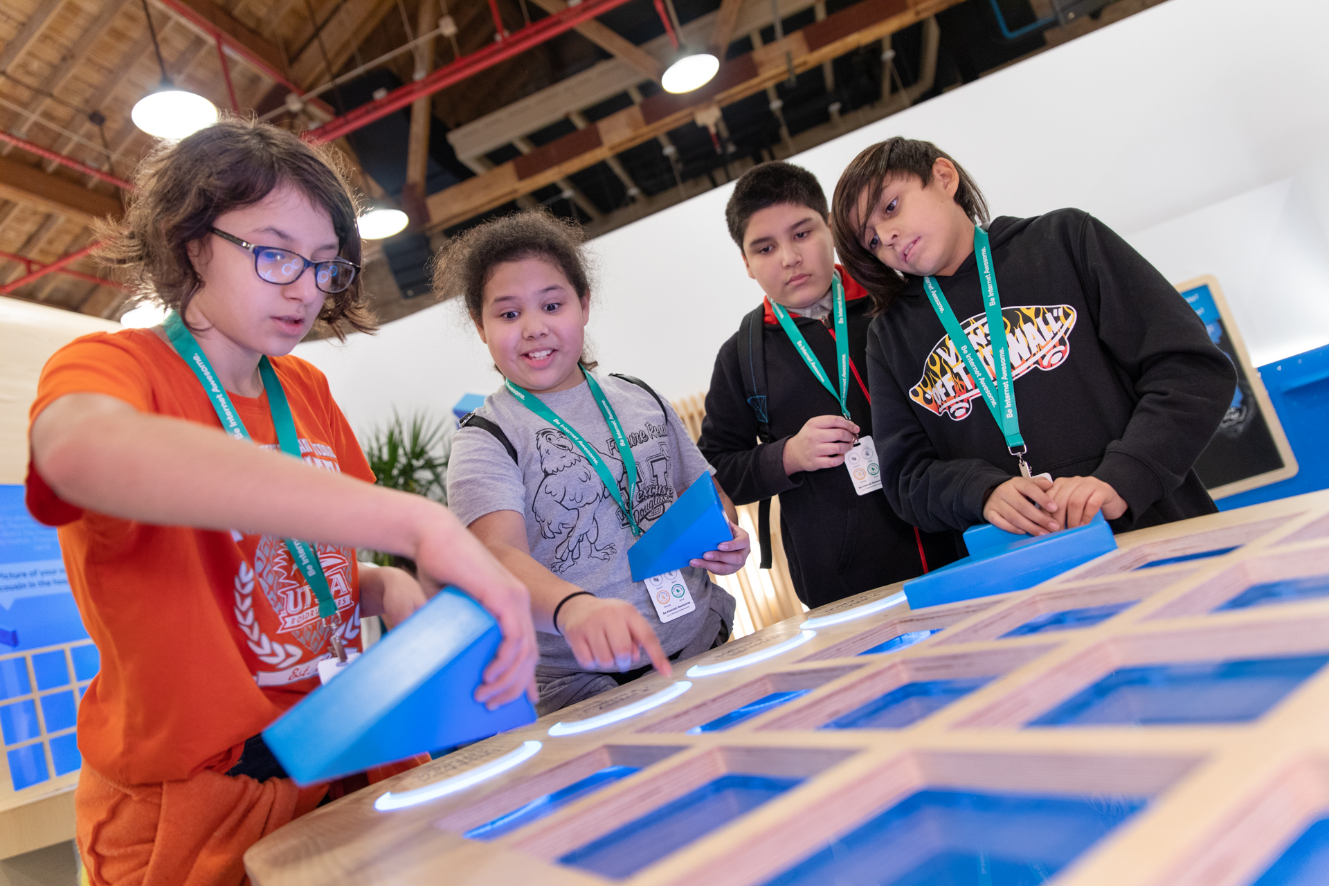

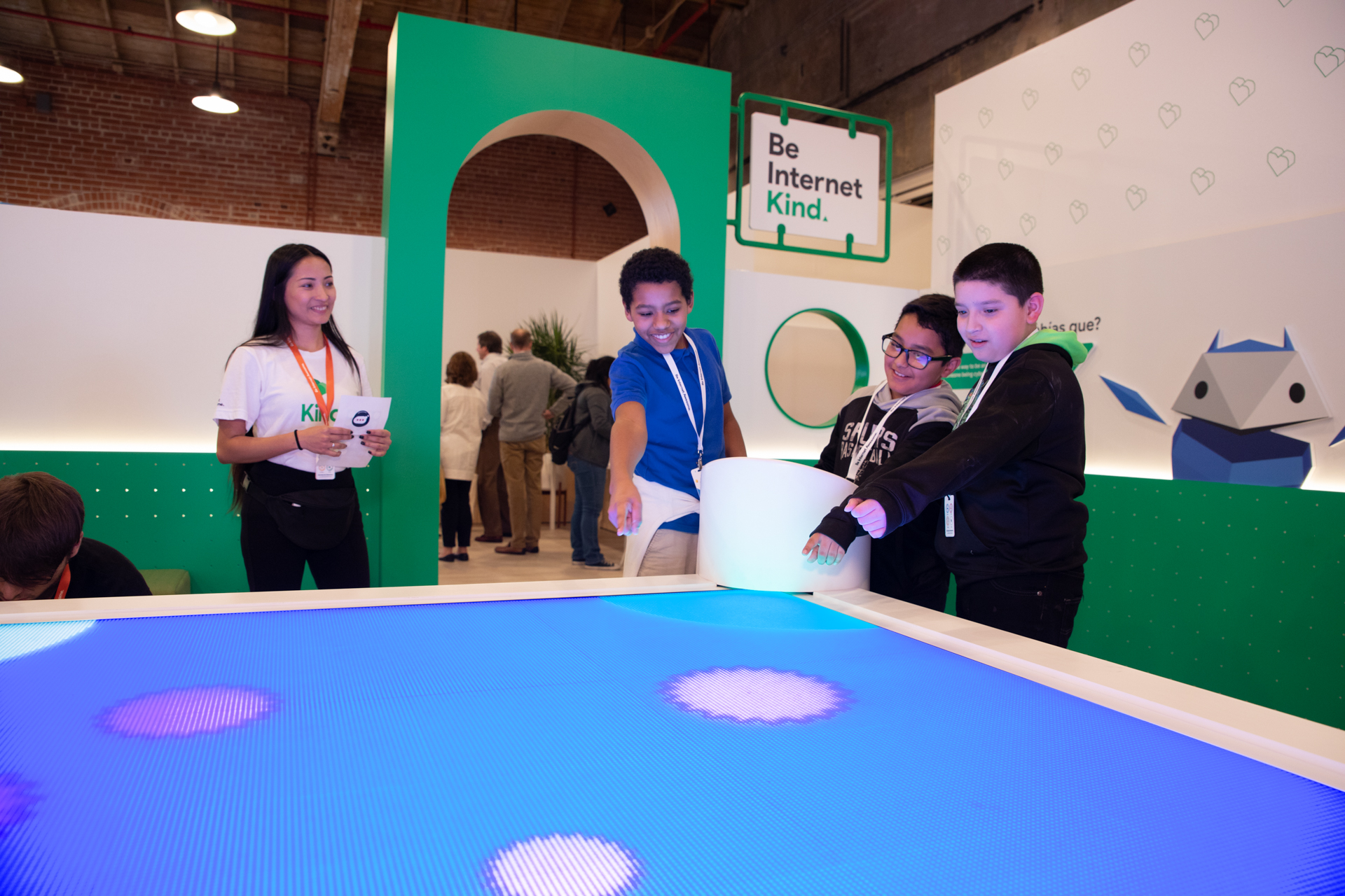
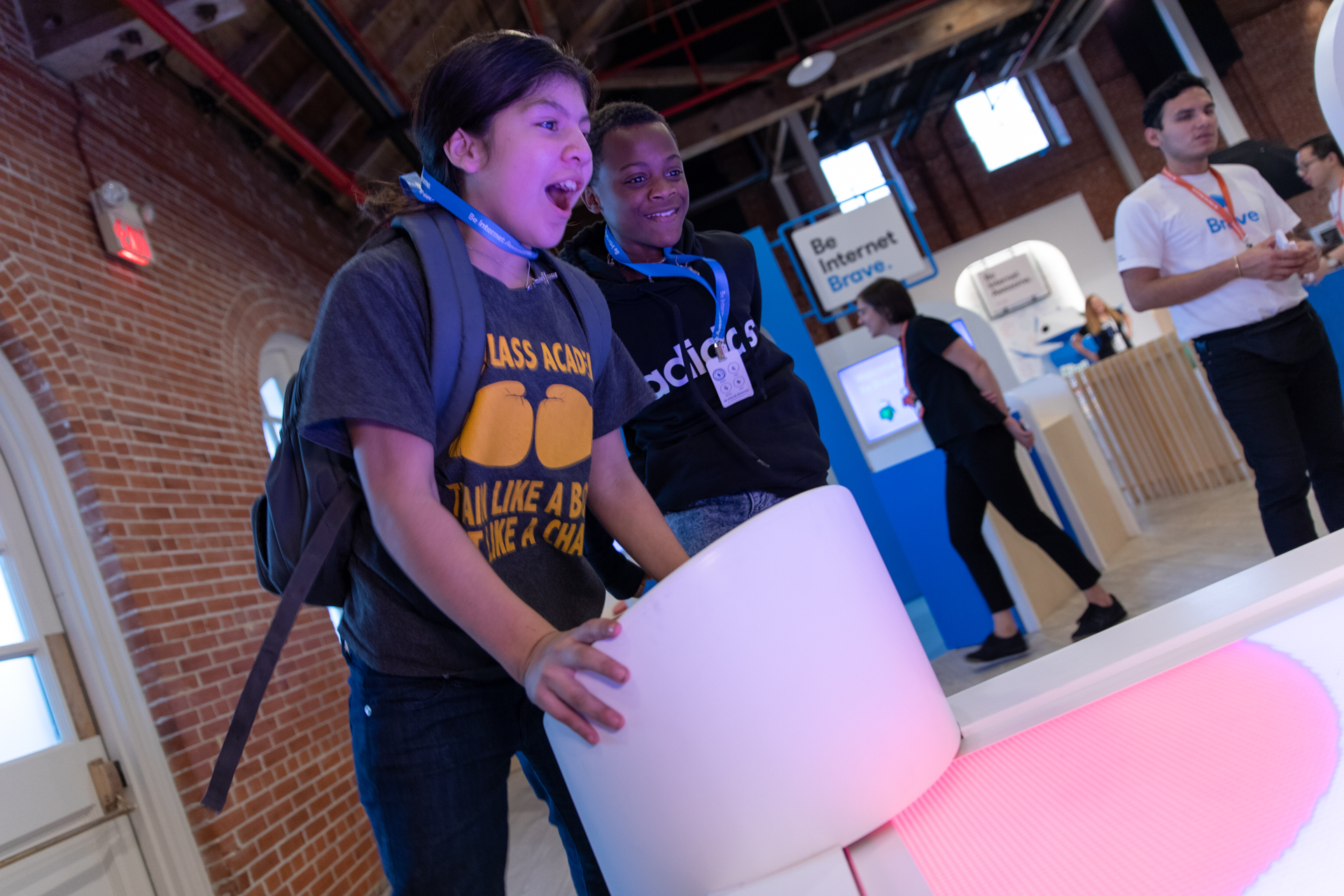
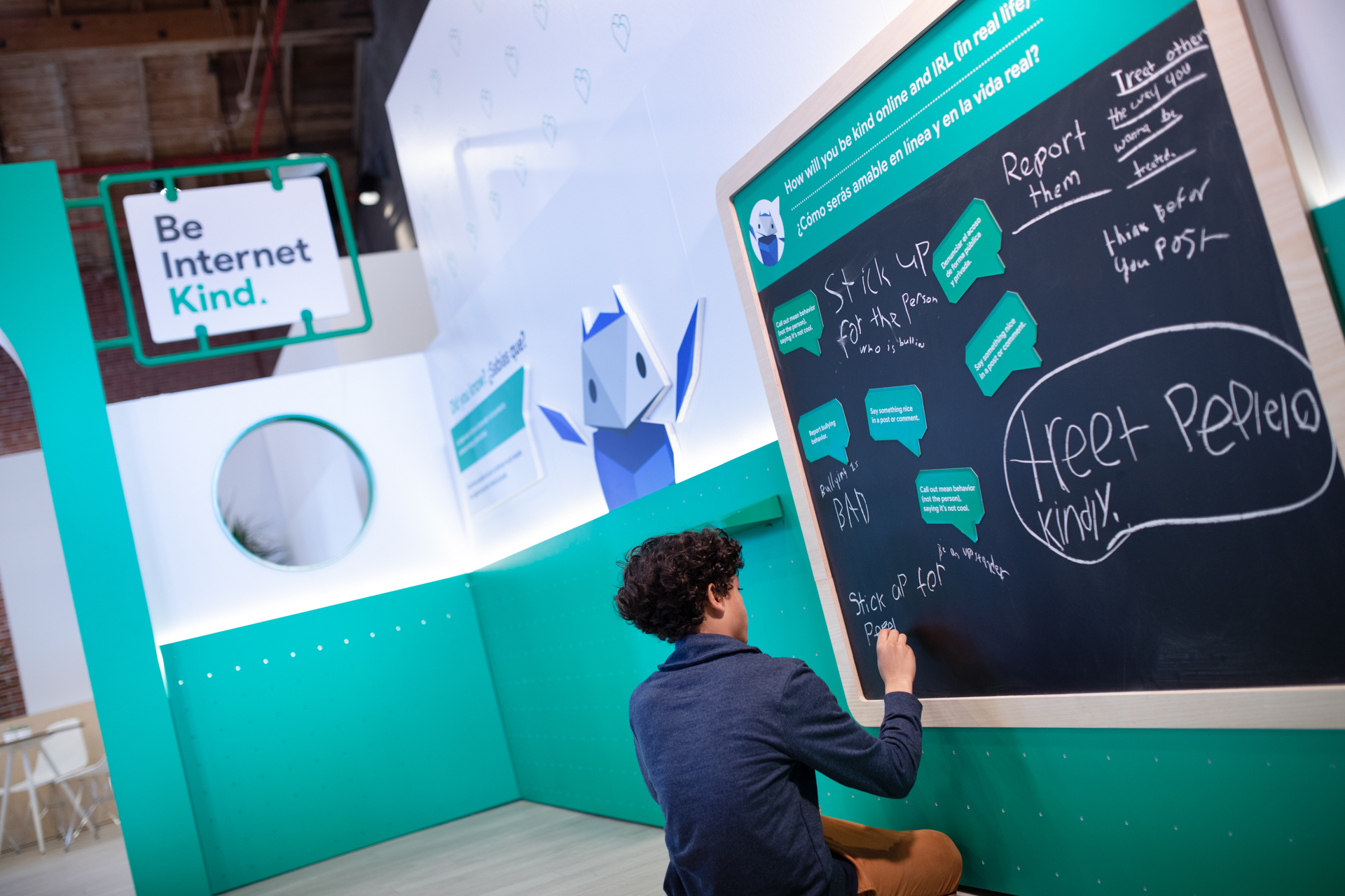
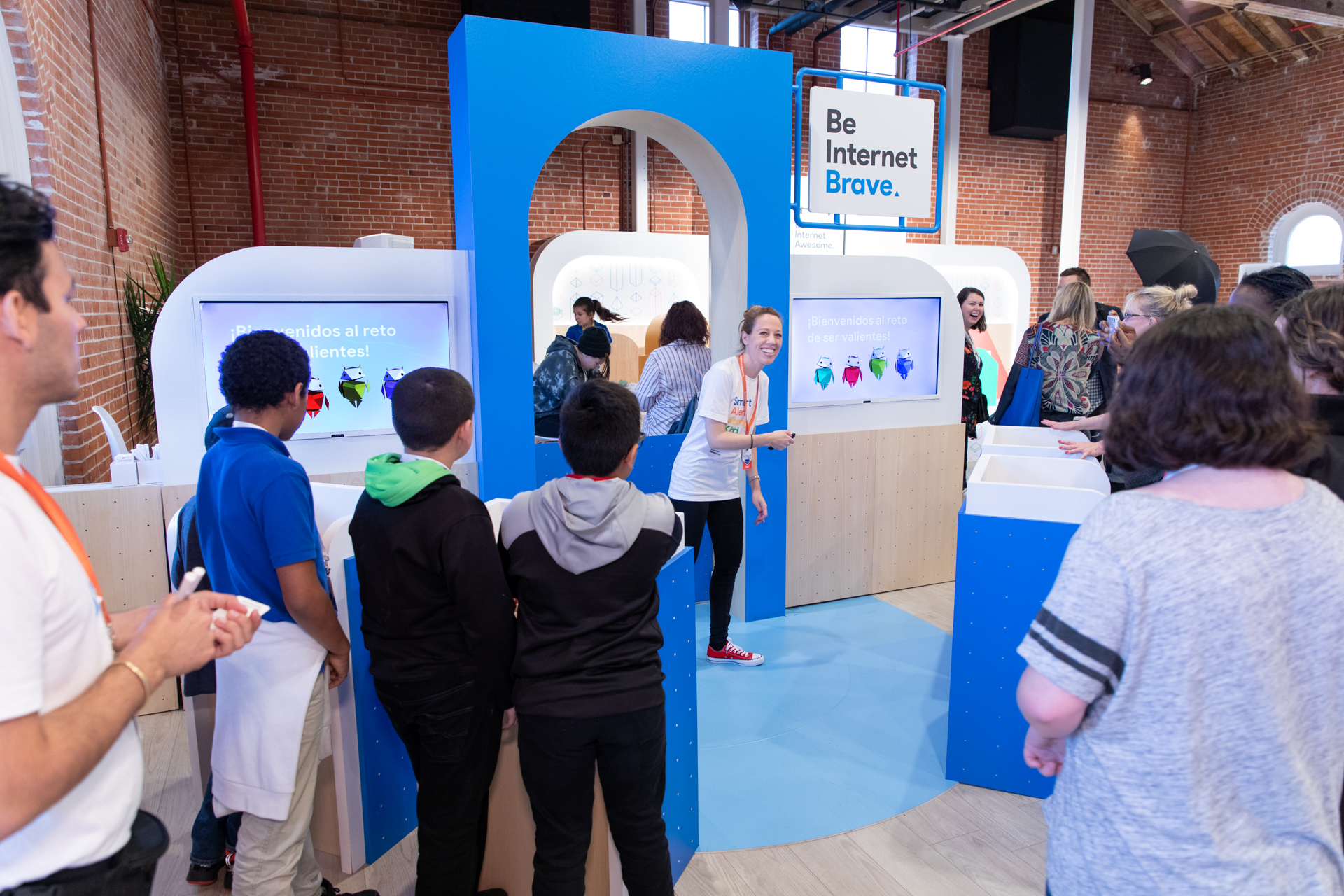
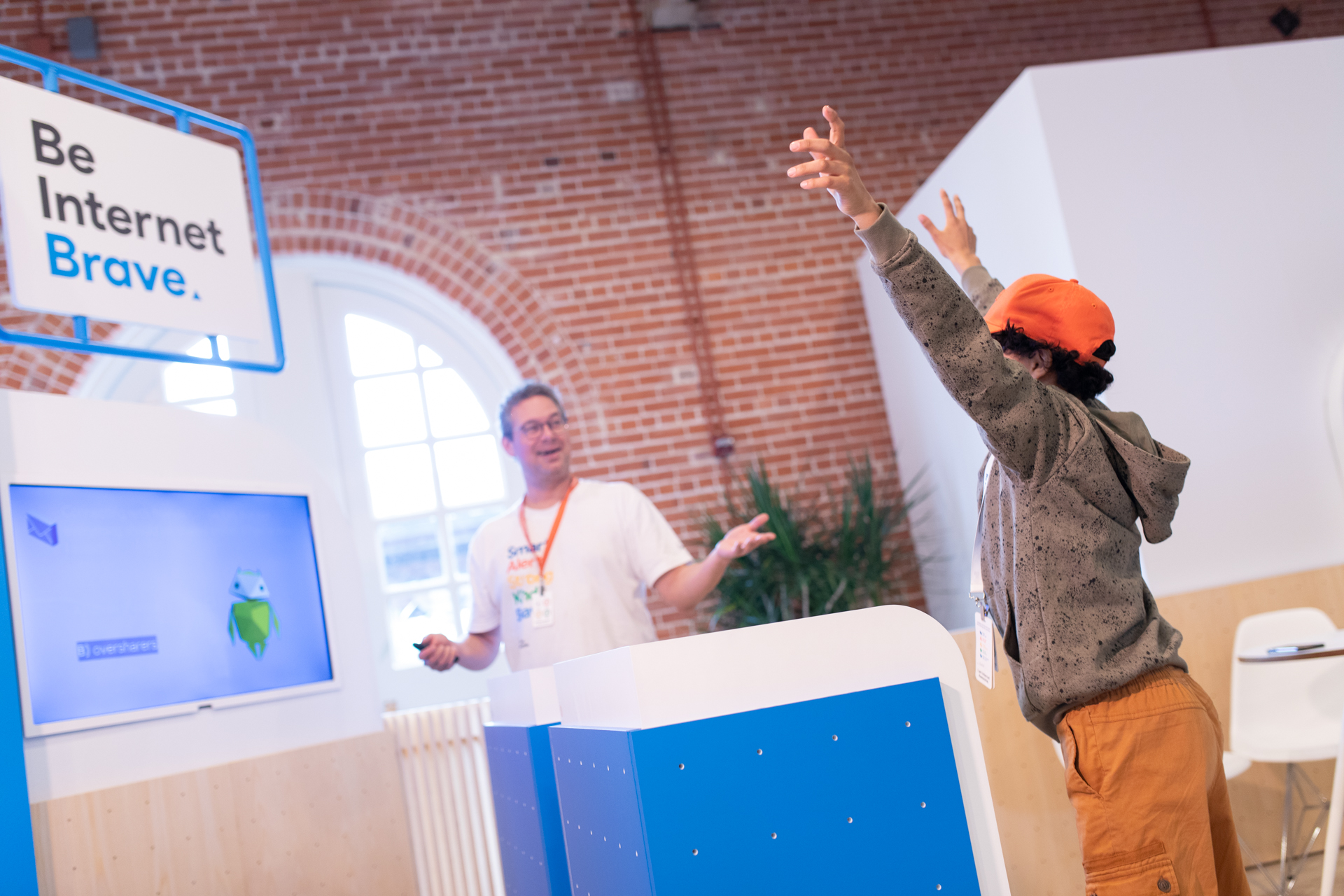


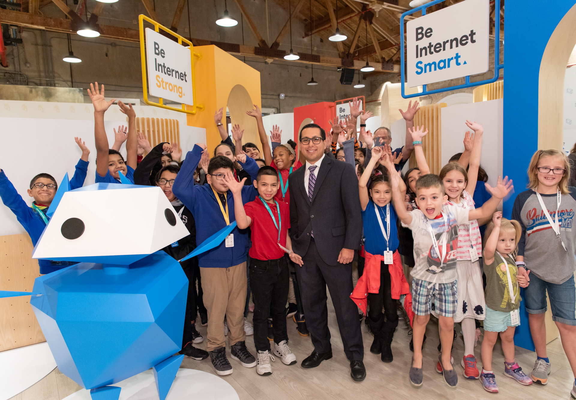
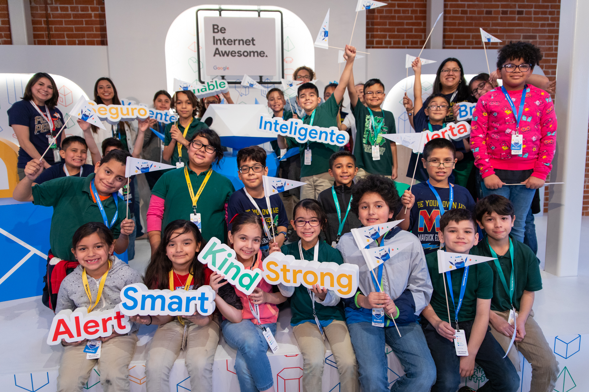

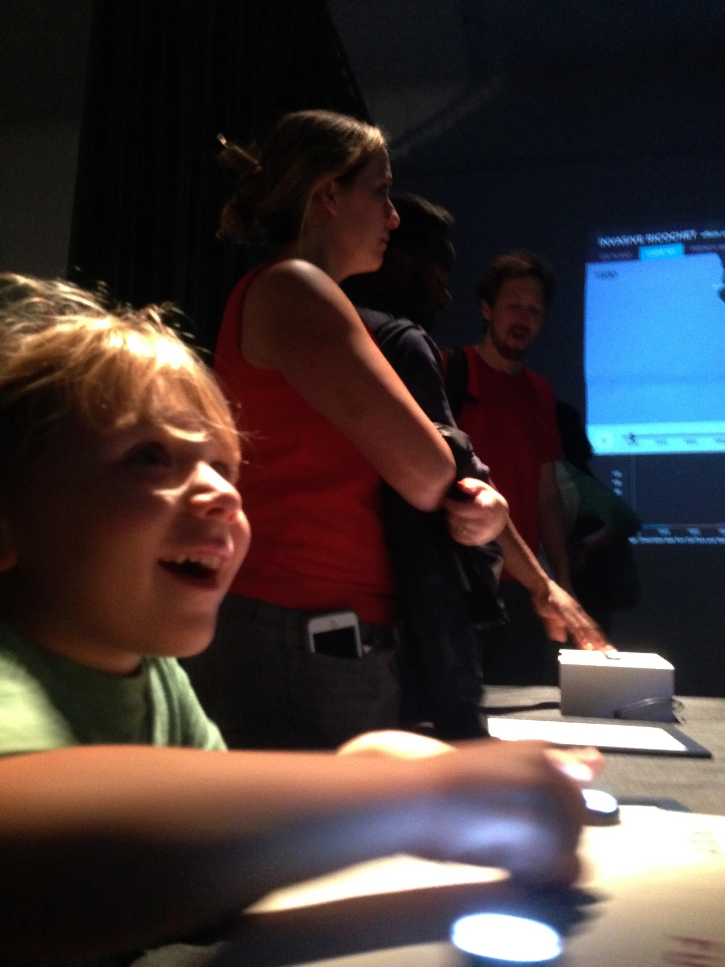
Type: 7,000 sq. ft experience featuring 5 zones where visitors engage with interactive kiosks teaching them how to be safe and smart online through fun, collaborative play.
Date: Safer Internet Day. February 4 - 6, San Antonio, Texas.
Client: Google
Description: Produced a large scale interactive exhibit and 3-day activation in San Antonio, TX teaching kids about online safety and digital citizenship. School groups, families and educators explored 5 “Pillars” of the Be Internet Awesome program through interactive and playful game zones. Deeplocal was our creative technology partner who managed the engineering and build of the experience. I led content development, supported experiential game design and development, produced and managed video and photo documentation, and managed the approval process across Google divisions. On Safer Internet Day (Feb. 5) Google hosted a panel discussion “Together for a Better Internet” with national organizations and included a special appearance by Texas state representative Diego Bernal.
Video and photos produced in collaboration with LOMA media: lomamedia.com. For more information see, g.co/BeInternetAwesome
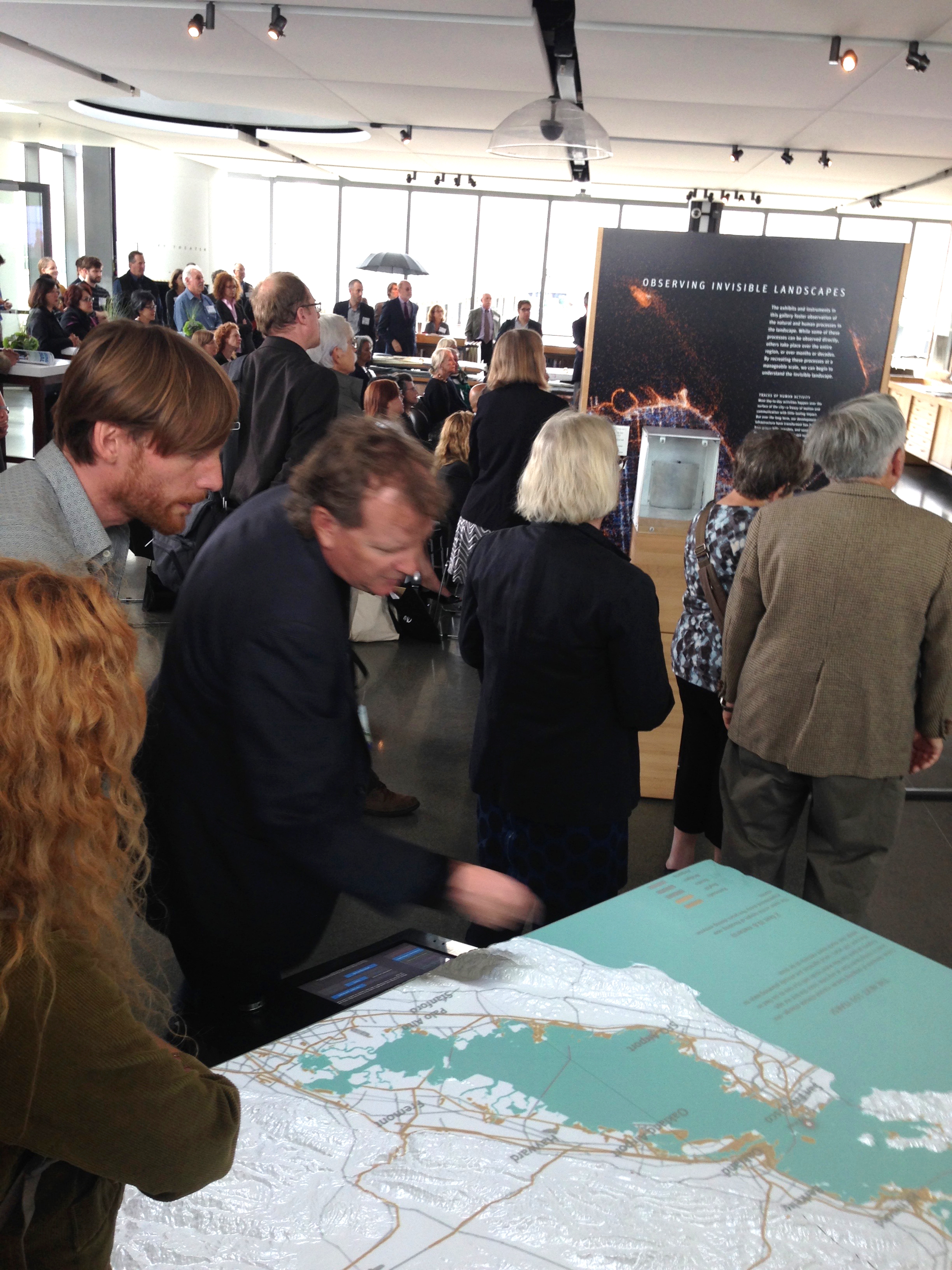
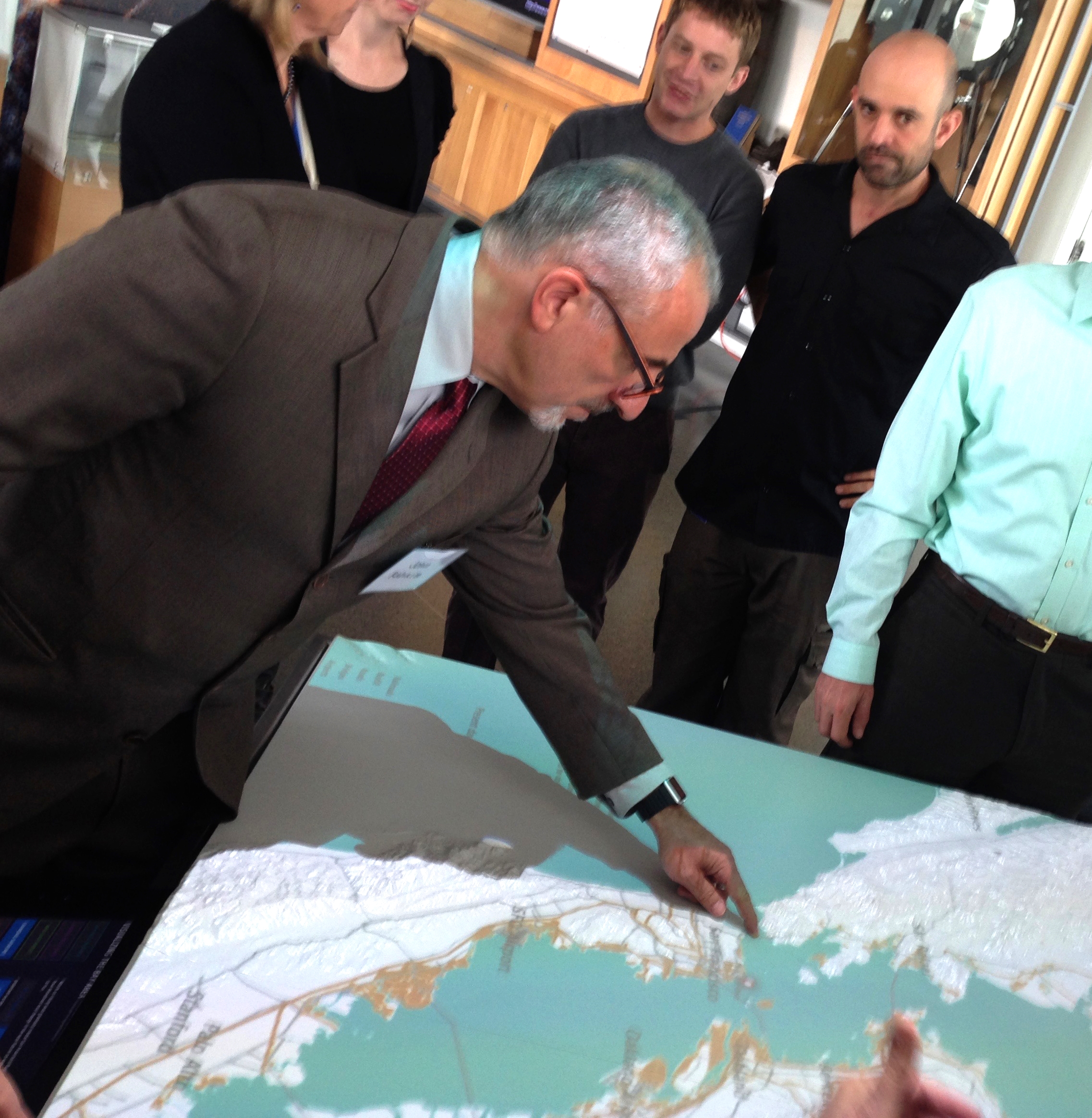
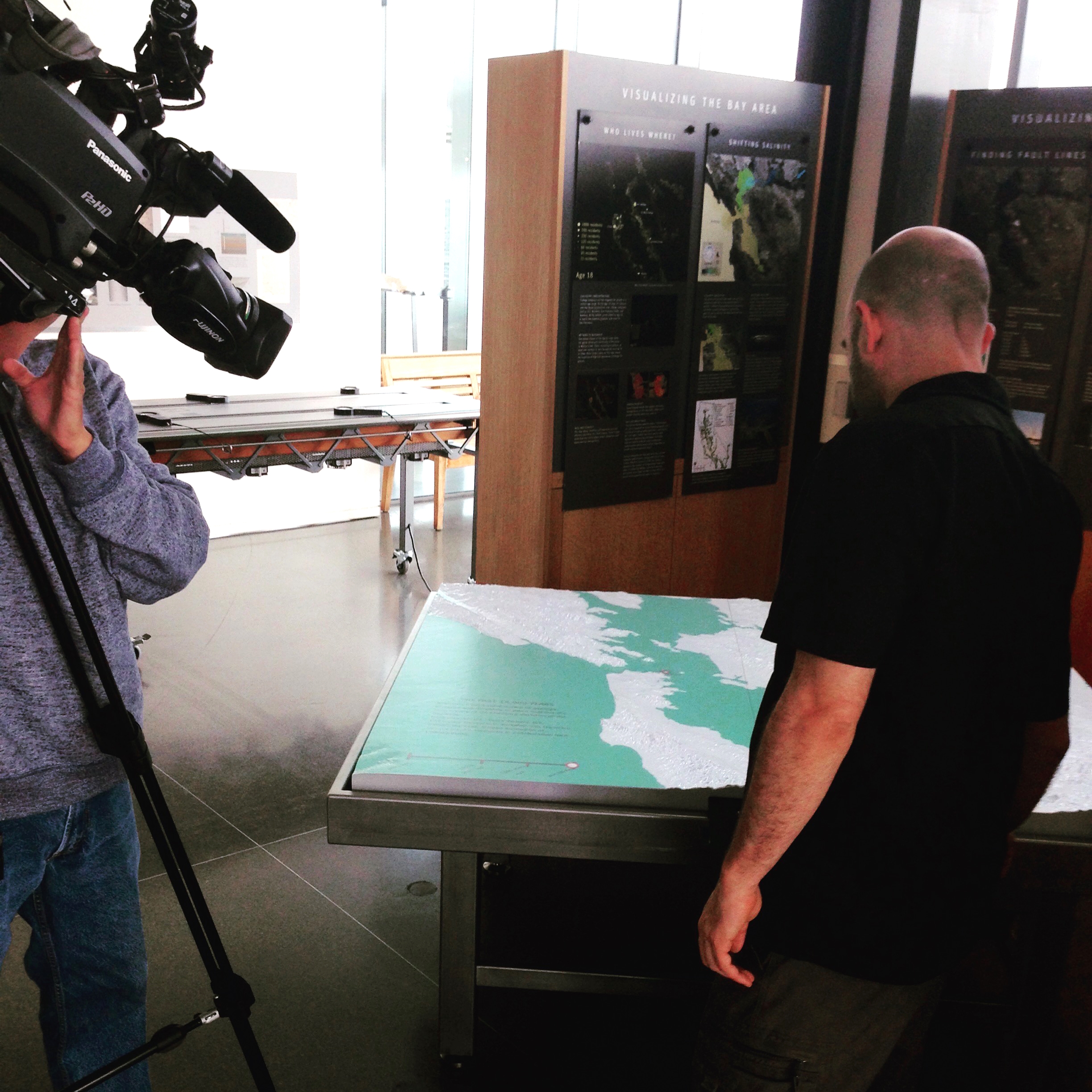
exploratorium - Changing Shorelines, Oct 2015
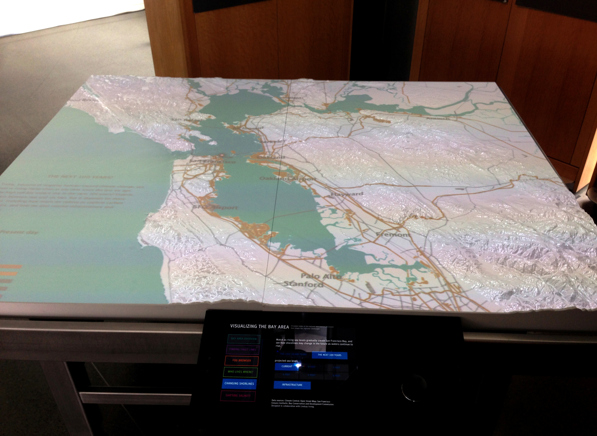
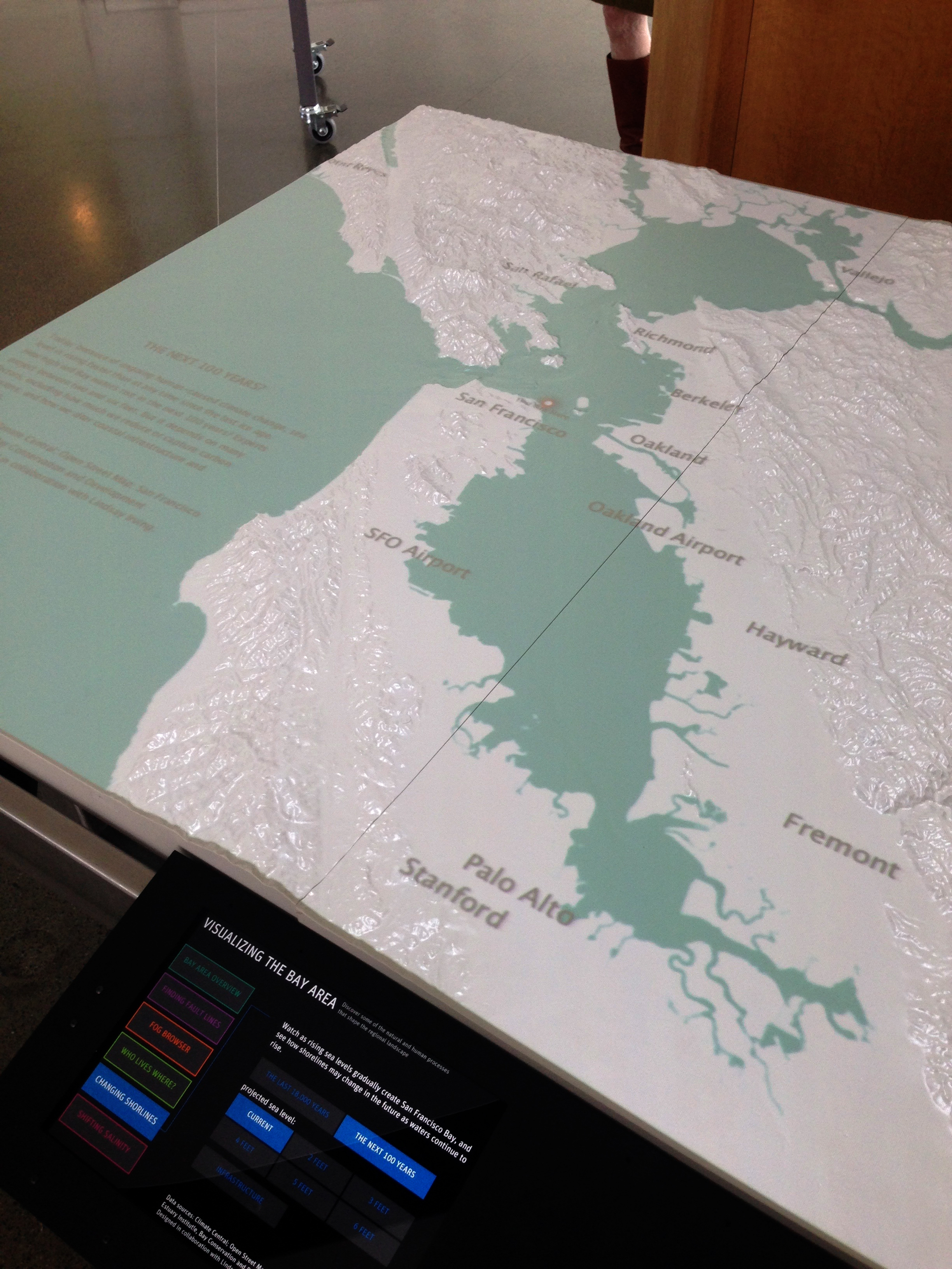
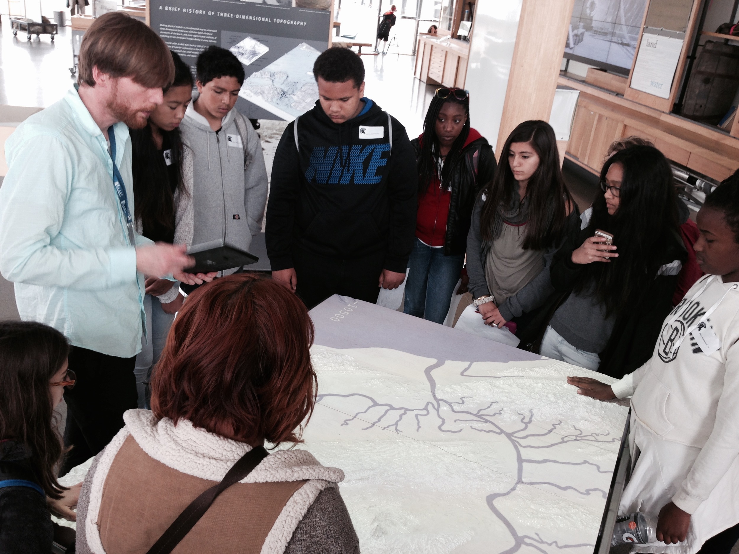
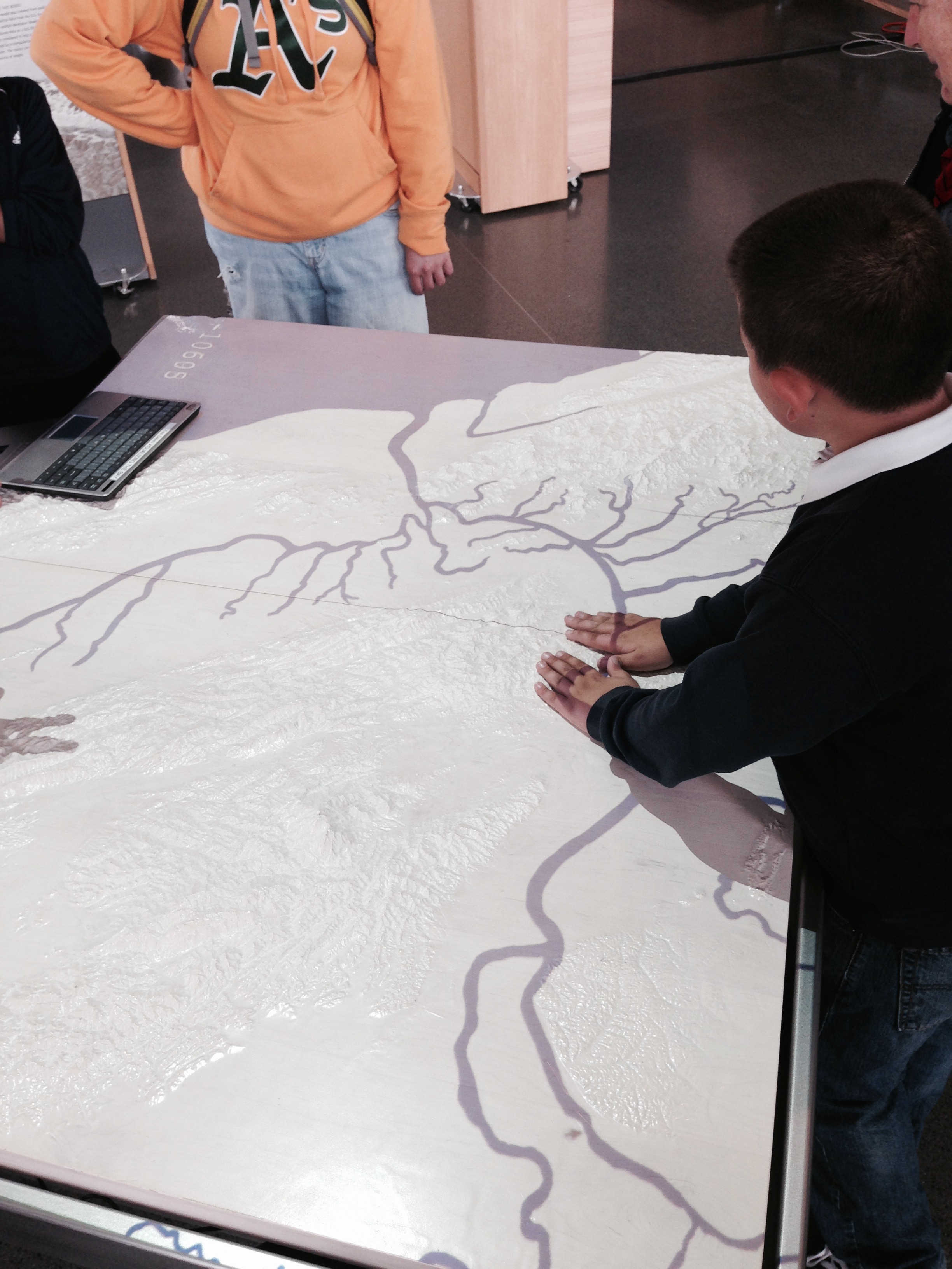
Type: Interactive visualization about Sea Level Rise for the Visualizing the Bay exhibit in the Bay Observatory Gallery, Exploratorium Museum.
Collaborators: Exploratorium Environment Program, San Francisco Estuary Institute, Climate Central, Bay Area Conservation and Development Commission (BCDC).
Date: February 2015 - October 2015 (currently on display)
Description: Developed during a data visualization residency, "Changing Shorelines" demonstrates how the San Francisco Bay formed over 18,000 years since the last ice age, as glaciers melted, sea levels gradually rose and moved through the Golden Gate. Data are projected onto the Visualizing the Bay exhibit, a 3D relief map of the Bay Area that serves as a projection surface for a suite of visualizations about the unseen forces that shape the region. Visitors can scroll through this long time period to see how the land and the sea shaped each other to the present day. Future scenarios can be selected on a digital tablet to reveal how two to six feet of projected sea level rise above current levels will impact a developed and populated shoreline.
Roles & Duties: Data Visualization Researcher in Residence
Worked with new media developers, scientific experts, and museum staff to design "Changing Shorelines", an interactive visualization about Bay Area sea level rise projected on a 3D relief map table showcased in the Bay Observatory Gallery.
Used Google Earth, QGIS, ArcGIS, Mapbbox Studio to integrate a broad spectrum of geospatial datasets into a custom Java and Processing-based software designed by Exploratorium exhibit developers.
Advised on program development, fostered relationships with scientific collaborators like the San Francisco Estuary Institute, Climate Central, NOAA, USGS, and Bay Area Coastal Development Commission
Special thanks to the talented team at the Exploratorium; Susan Schwartzenberg, Eyal Shahar, Sebastian Martin, Kevin Boyd, Owen Lawrence, Toni Dancu, and urban fellows, Matthew Booker and Jason Groves!
Download METHODS to learn more about the development process.
gray area foundation for the arts - Shoreline Dimensions, 2015
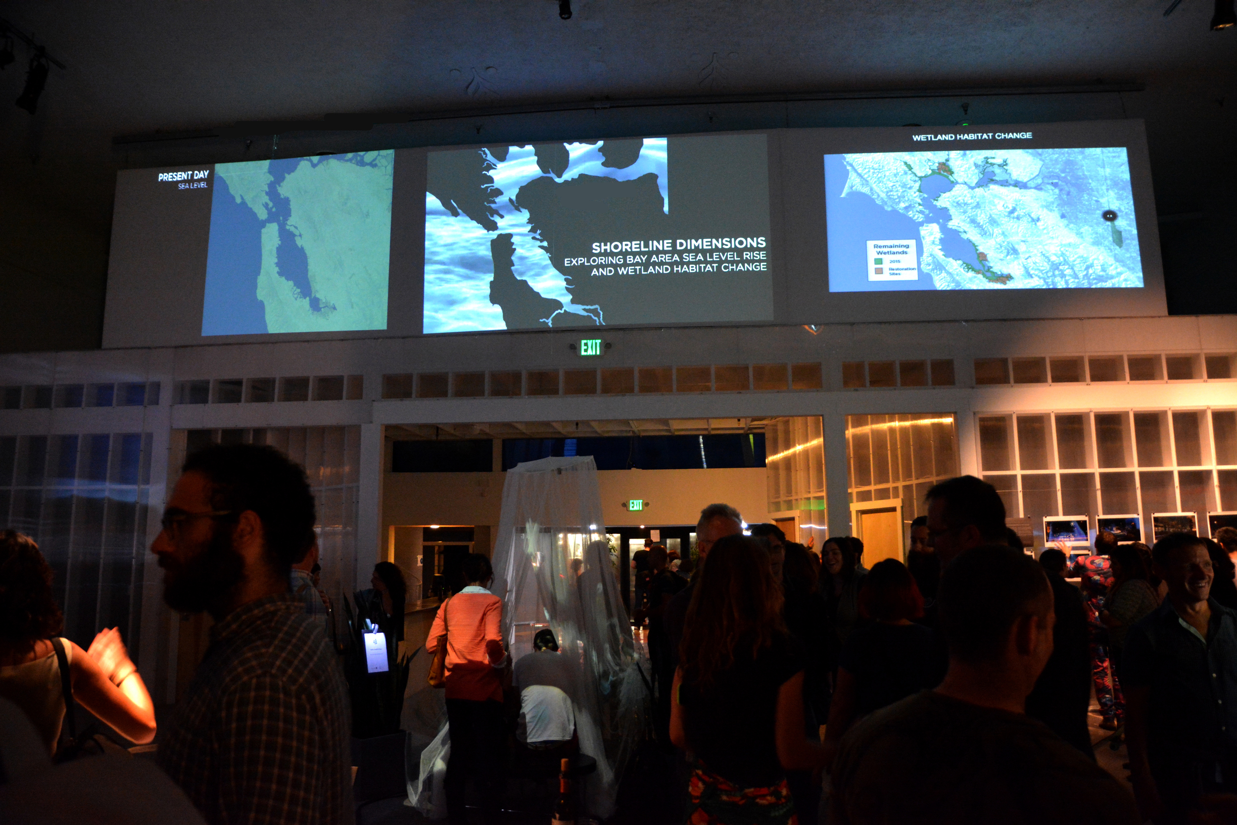
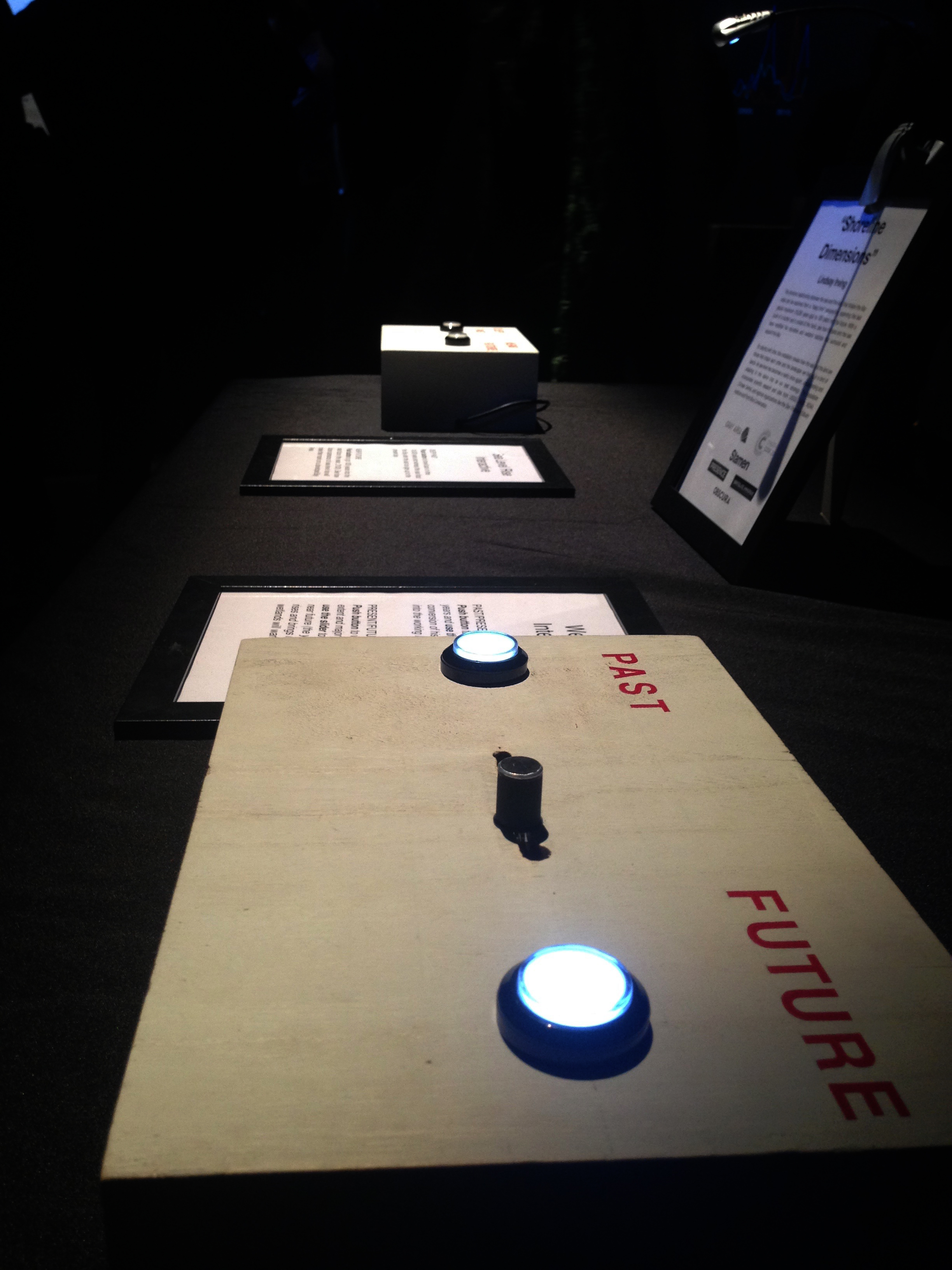
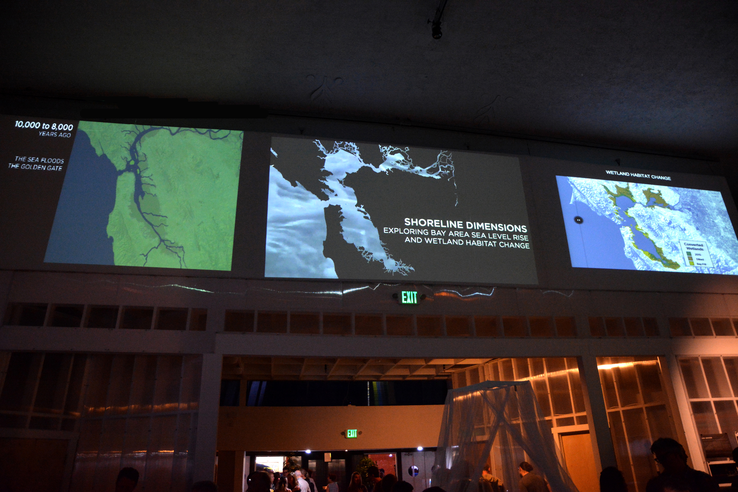
Type: An interactive web and video-based installation about Bay Area sea level rise and wetland habitat change as part of the Creative Code Fellowship and Summer Immersive. From 2 consoles on the ground, users control digital media projected on three (7' x 4') screens above the gallery.
Collaborators: Gray Area Foundation for the Arts, Stamen Design, Presence, Obscura Digital, BriteLite Immersive, and the Exploratorium.
Date: June - August 2015
Description: The dynamic relationship between the sea and the land that shape the Bay Area can be explored from a “deep time” perspective, spanning the last glacial maximum (18,000 years ago) to 100 years into the future. With a push of a button and a swipe of the hand, audiences can see how humans and the sea have modified the shoreline and wetland habitats that surround and support the Bay. By playing with time, this installation reveals how the sea and the land are forces that shape each other and the landscape we live on in a kind of dance. As sea level rise becomes a reality once again, understanding and adapting to this dance may be our best strategy. The installation incorporates scientific research and data from USGS, NOAA, Climate Central, Scripps, and regional organizations like the San Francisco Estuary Institute and Point Blue Conservation. It was a critical prototype in the development of the Exploratorium's "Changing Shorelines" visualization that was unveiled in Bay Observatory Gallery in September 2015. I used JQuery, Javascript, HTML, NodeJS, Arduino, Max/MSP, and Processing for interactive development and design. QGIS, ArcGIS, and Mapbox Studio for geospatial data integration and mapping. Special thanks to Matt Ganucheau, Mark Hellar, Blaise Bertucci, and Eyal Shahar for technical assistance! The Creative Code Fellowship offers individuals 12 weeks of creative coding classes and a chance to explore a computational art and research project culminating in a final showcase. The Gray Area Foundation for the Arts co-sponsors the fellowship with San Francisco based design companies, Stamen Design, Obscura Digital, BriteLite Immersive, and Presence.
For more information about the process, see the Creative Code Review posts in my blog


california academy of sciences - Global Biomes, May 2012
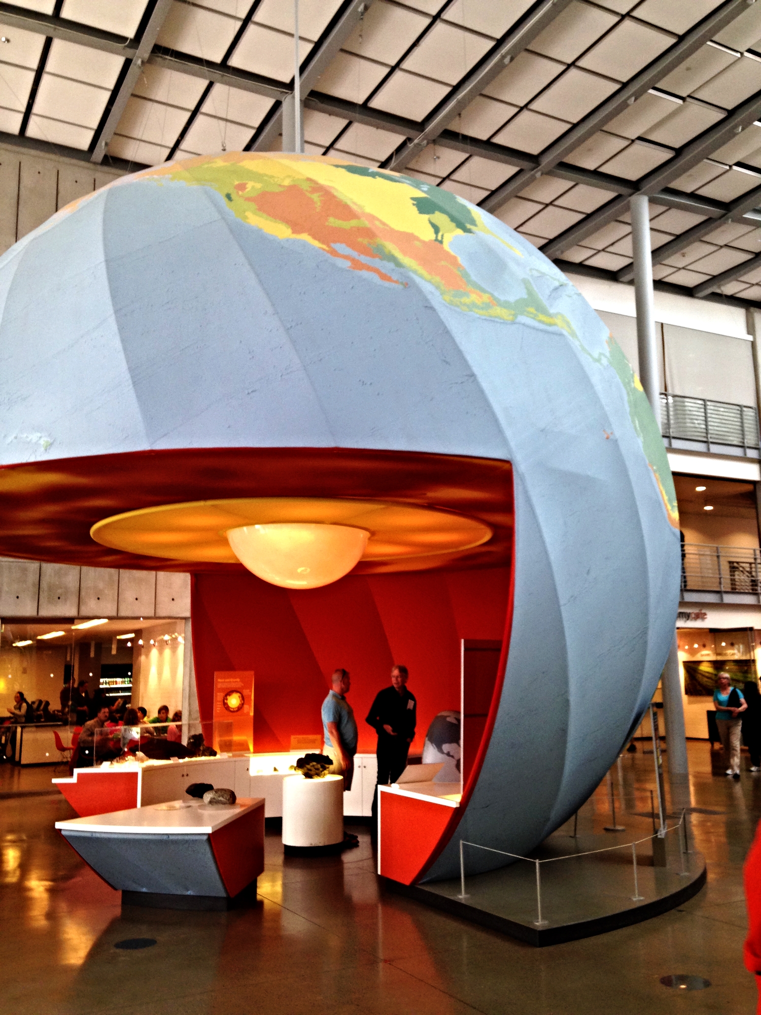
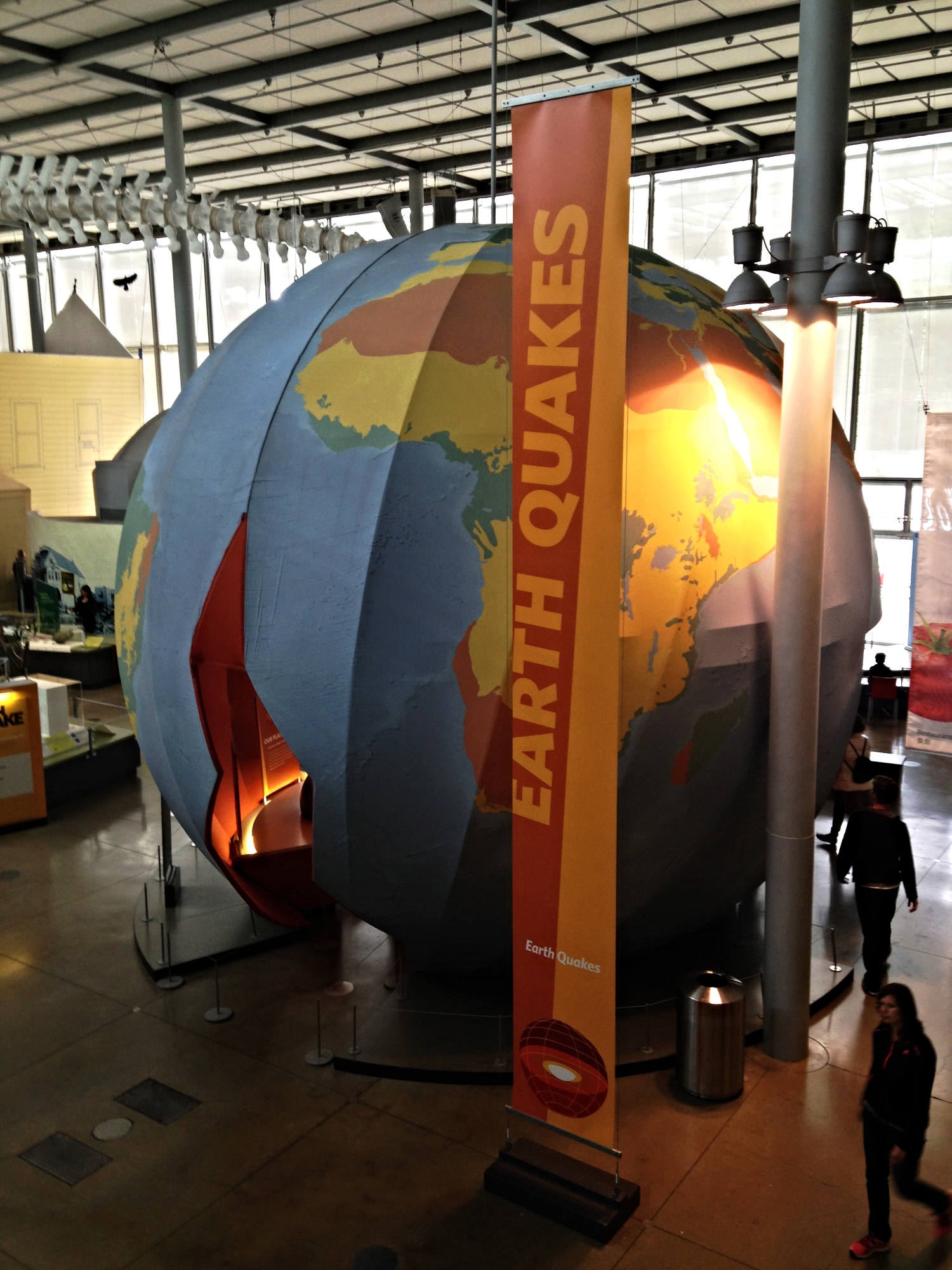
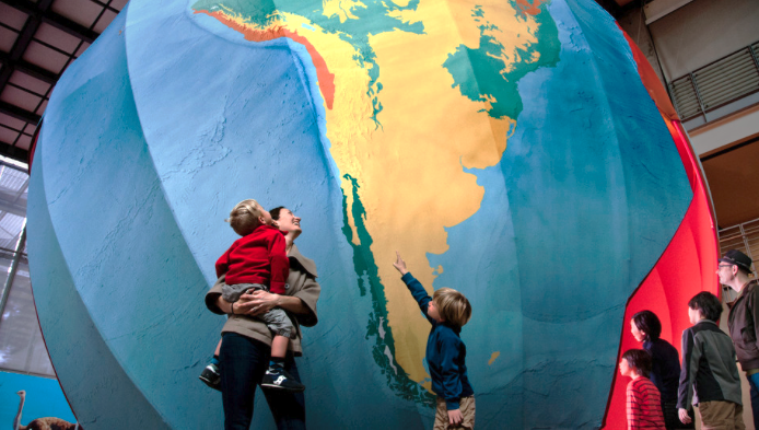
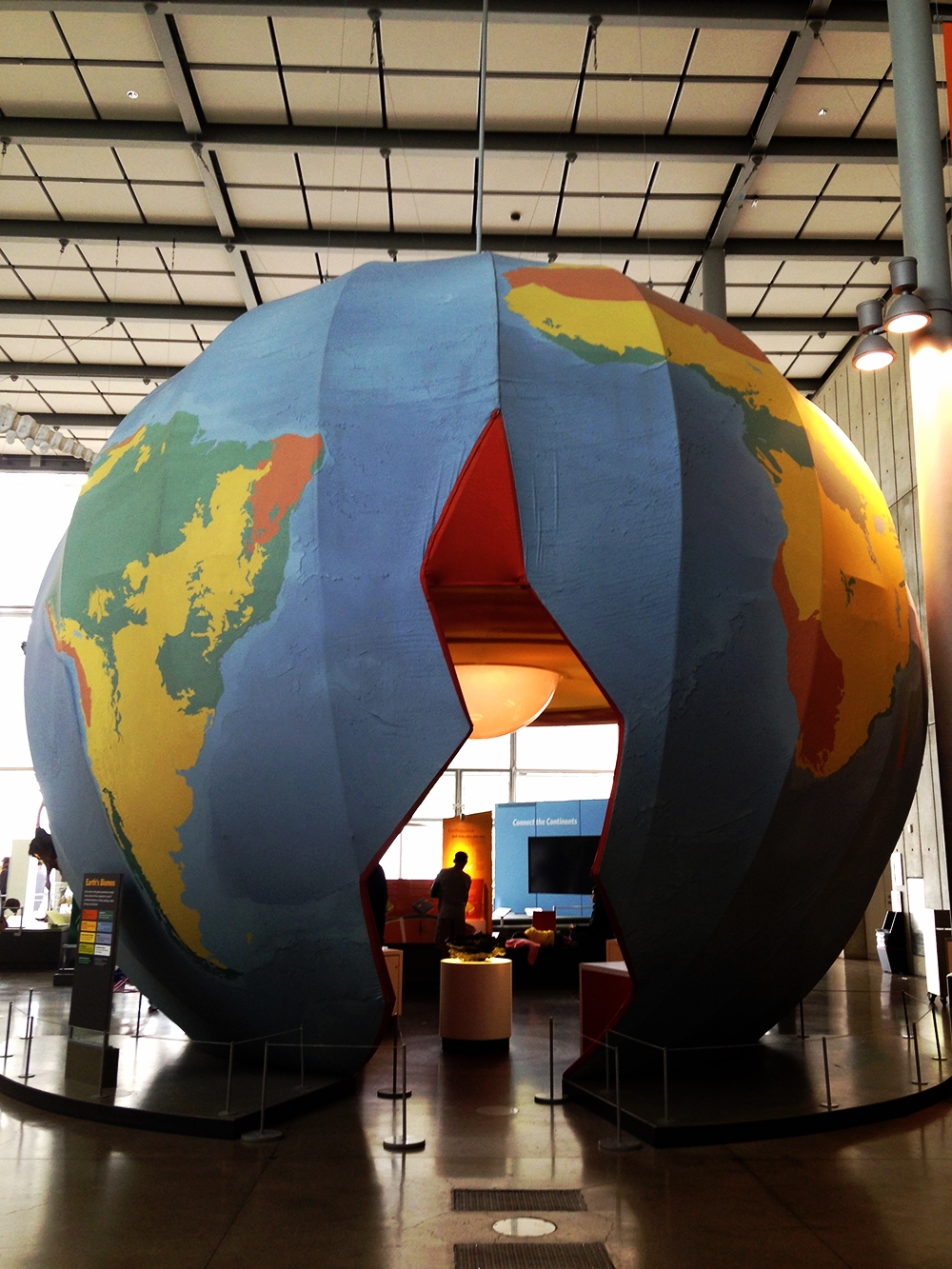
Type: Installation featured in the Earthquake: Life on a Dynamic Planet exhibit
Collaborators: Center for Applied Biodiversity Informatics (CABI), Exhibits, Visualization Studio, California Academy of Sciences.
Date: May 2012 - 2018.
Description: Using GIS and Adobe Illustrator, I assisted Exhibits staff in the design and fabrication of a 1/1,480 scale model of the Earth illustrating 9 terrestrial ecoregions where life has adapted to a set of conditions based on climate, geology, water, soil type, and latitude. Derived from World Wildlife Fund's Terrestrial Ecoregions data, the installation features the following biomes: Desert, Boreal Forest, Savanna/Grassland/Shrubland, Coniferous Forest, Temperate Deciduous Forest, Tropical Forest, Ocean, Tundra, Permamnent Ice and Snow. Data research, acquisition, management, and cartography.