
google - Be internet awesome collateral, workshop kits - 2019

Type: Be Internet Awesome Workshop kit of educational resources and collateral
Date: May 2019
Description: Part of Google's Be Internet Awesome program, we produced a educator's kit of workshop materials for teachers and parents. The kit was part of a national award program with the National Parent Teacher’s Association. Facilitators can lead discussions on the pillars of internet safety and digital citizenship on a customized pixelbook, USB drive filled with workshop materials, posters, family and teacher guides, as well as fun keepsake trophy and banner for their school. All materials are bilingual (English and Spanish) for kids and families with kids ages 8 - 12 years old. Kit creative design and production produced in collaboration with Orchid Creation.
Roles & Duties: Producer. Managed the production of the kits and the materials from conception to distribution. Developed and managed the production schedule and review cycle between Google leads, creative agency, and external vendors (production design, printing, and shipping vendors). Created a collateral inventory request and shipping process to distribute 190 kits to Google partners across the USA.
nature in the city + sf dept of the environment - nature in the city map, 2017
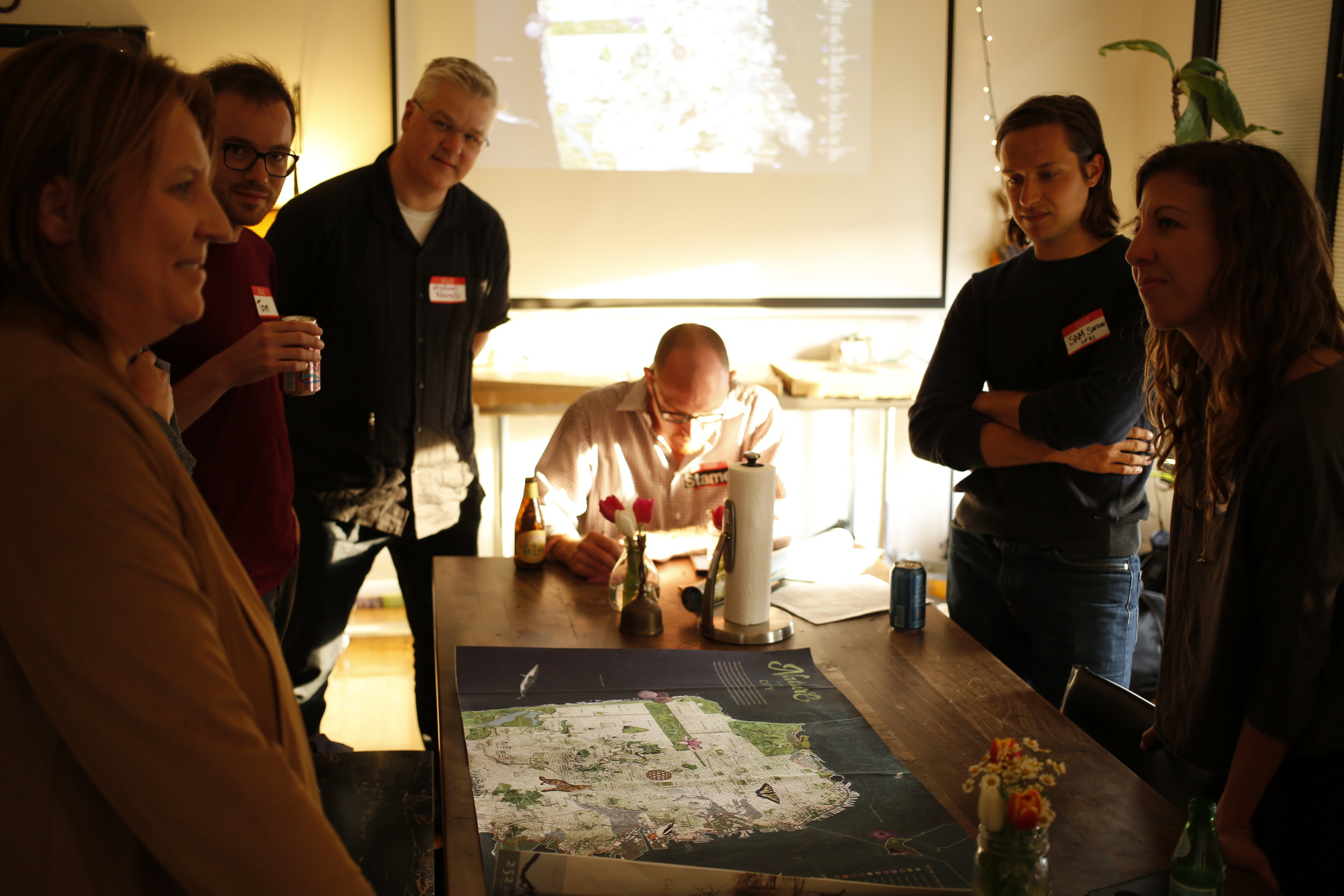
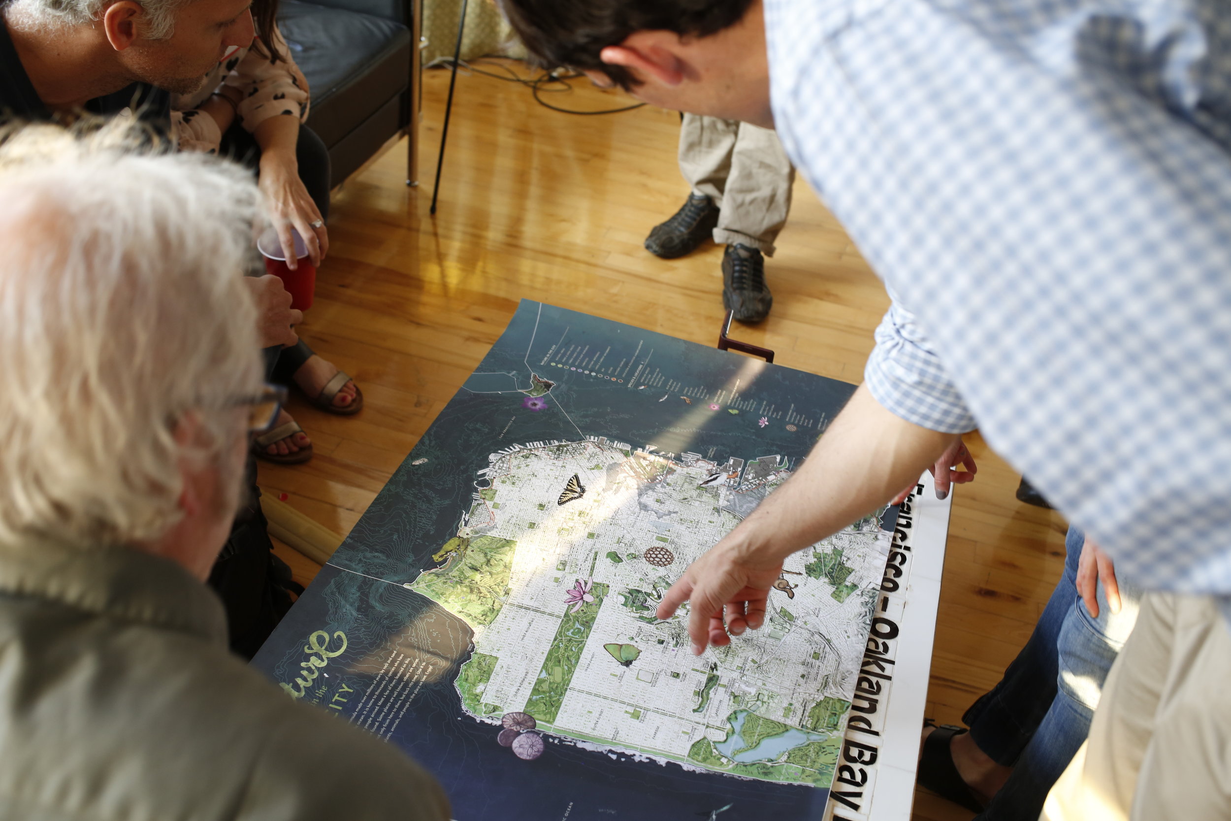
Nature in the City Map (FRONT) - 36 x 24'' acrylic on paper. Artist, Jane Kim, Designer, Leah Elamin, Content, Mary Ellen Hannibal.
Nature in the City Map (BACK) - 36 x 24'' acrylic on paper. Artist, Jane Kim, Designer, Leah Elamin, Content, Mary Ellen Hannibal.
Type: 36 x 24'' Fine art map depicting the natural areas and key species of San Francisco
Date: Dec 2017
Collaborators: Nature in the City (Client). San Francisco Department of the Environment, SF Planning Department, The Presidio Trust, The National Park Service, Exploratorium, California Academy of Sciences, SF Public Library.
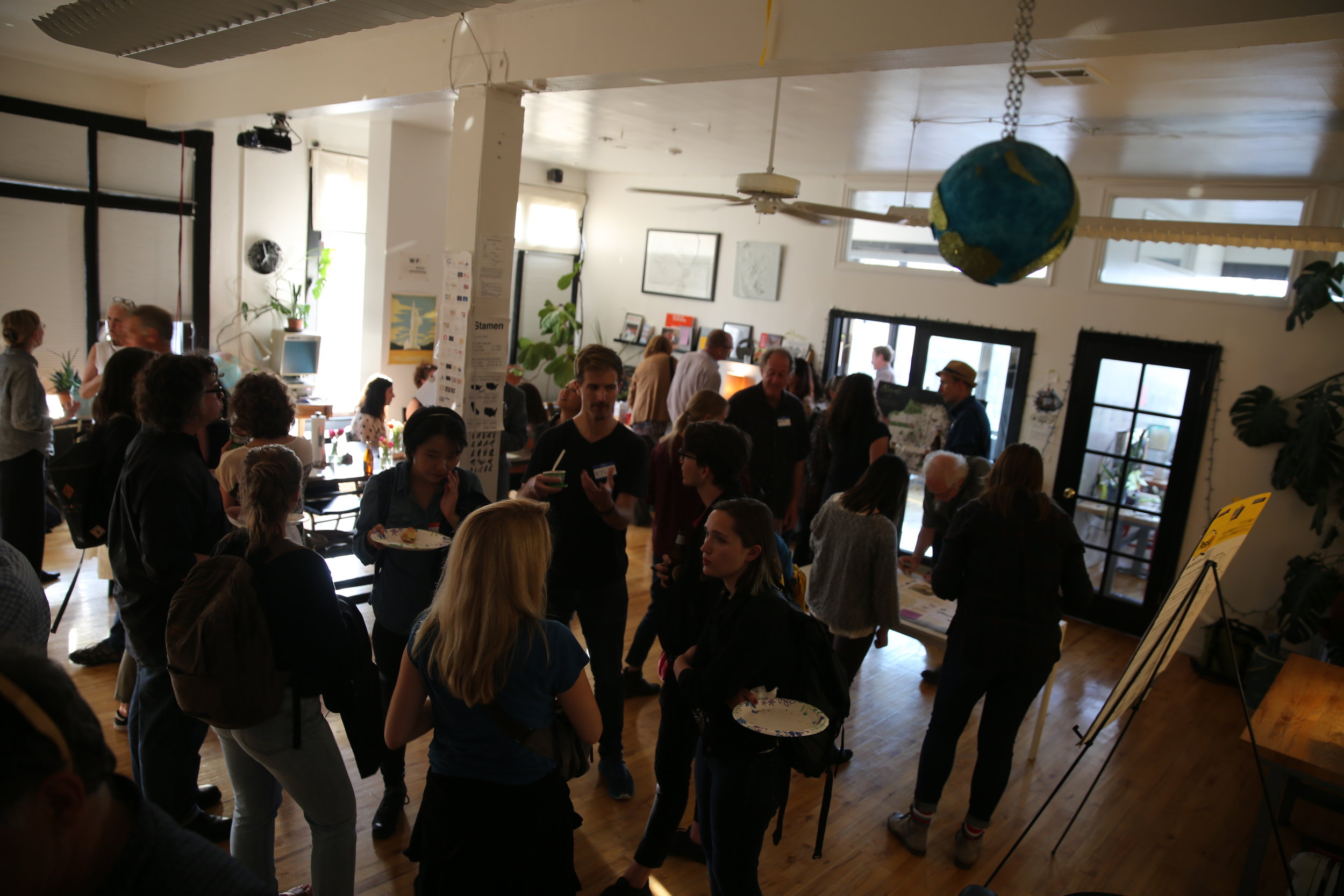
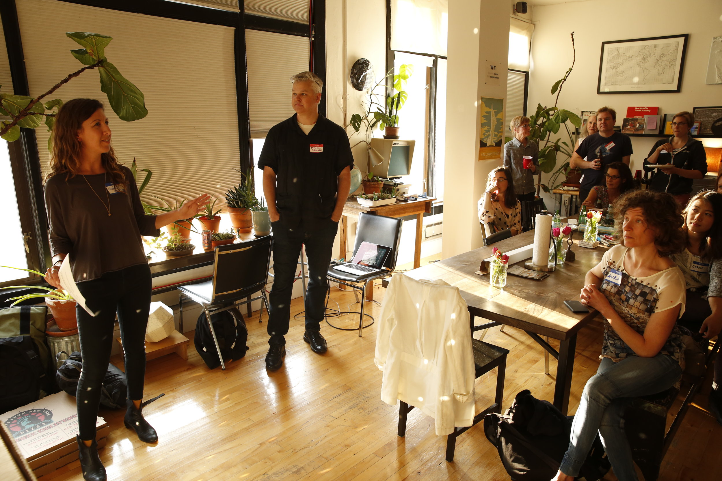
Description: Develop and execute a production and outreach plan for the printing of a large-scale map that integrates original artwork from a renowned artist, written content, and geospatial data from a multi-agency team working in the environmental education sectors in San Francisco. 50,000 maps will be distributed by collaborating agencies to San Francisco residents to encourage engagement with the natural areas and species around the city.
Roles & Duties: Project Manager & Cartographer
Lead regular all-team meetings, establish a production schedule, and develop a design and review process to track progress and needs between the creative team and project leads.
Scope and negotiate printing and framing logistics with external vendors for a print run of 50,000 copies of the map to be circulated to San Francisco residents, and a smaller run of framed, custom prints for donors.
Advise project leads on the marketing and distribution of the maps via the project website, social media channels, and ways to maximize partnerships with collaborating agencies and retail outlets.
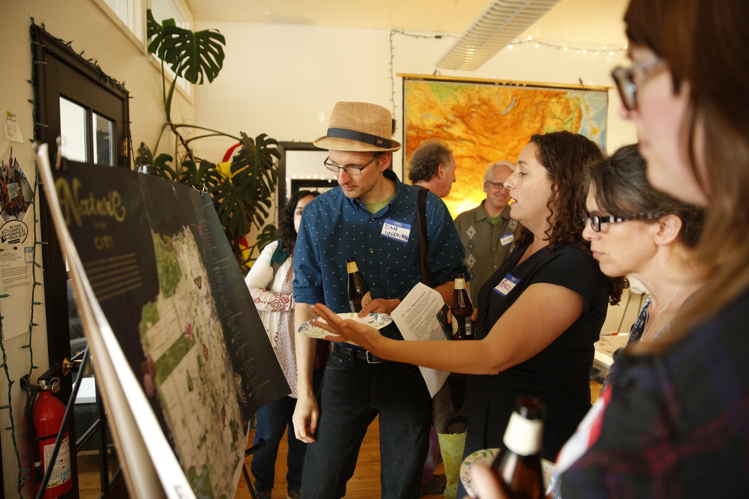
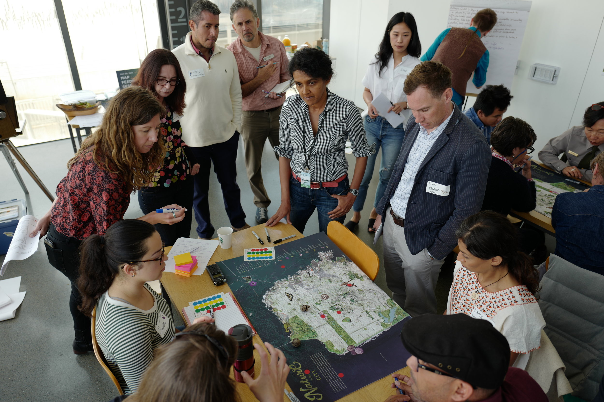
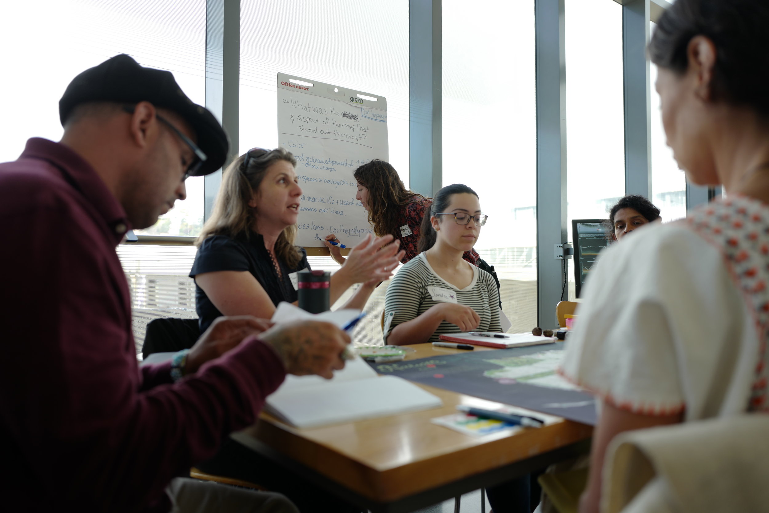
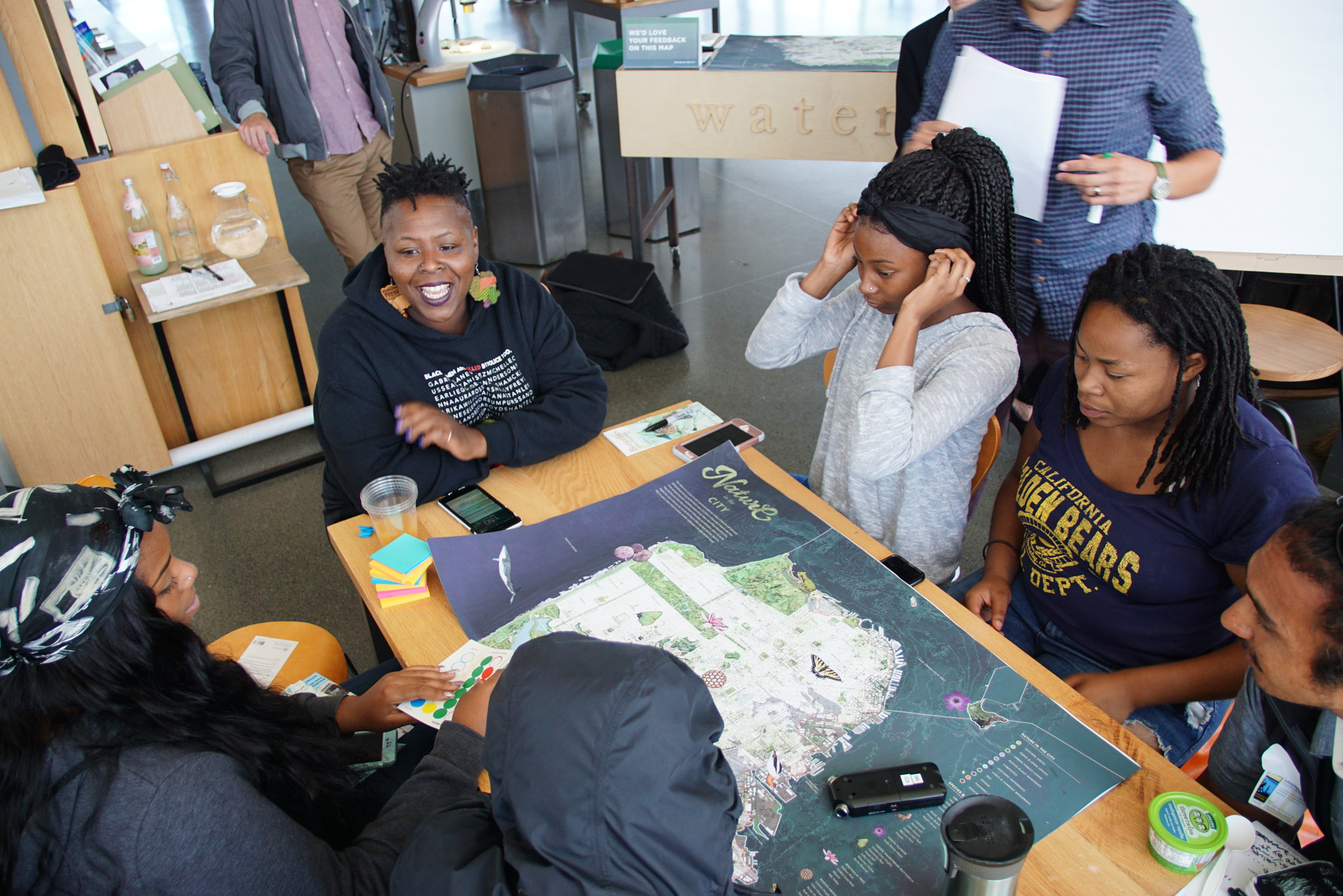
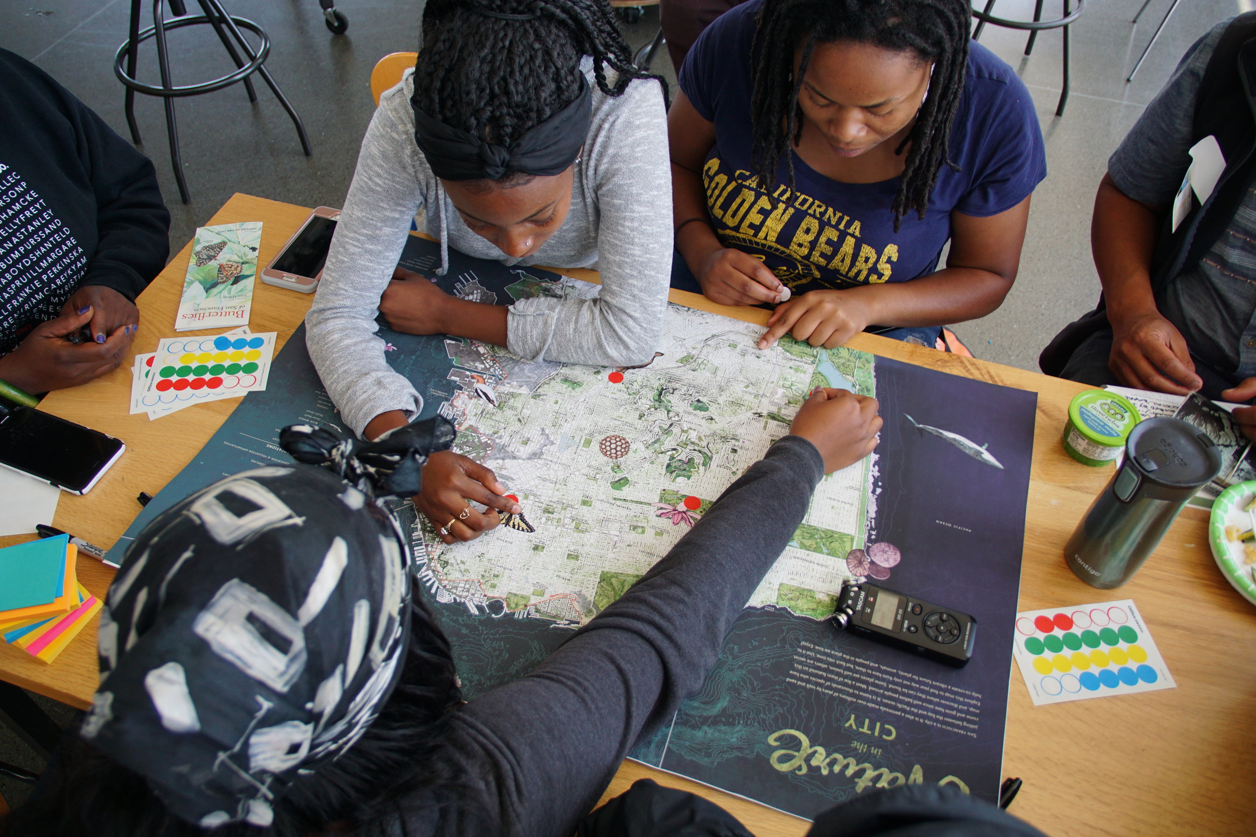
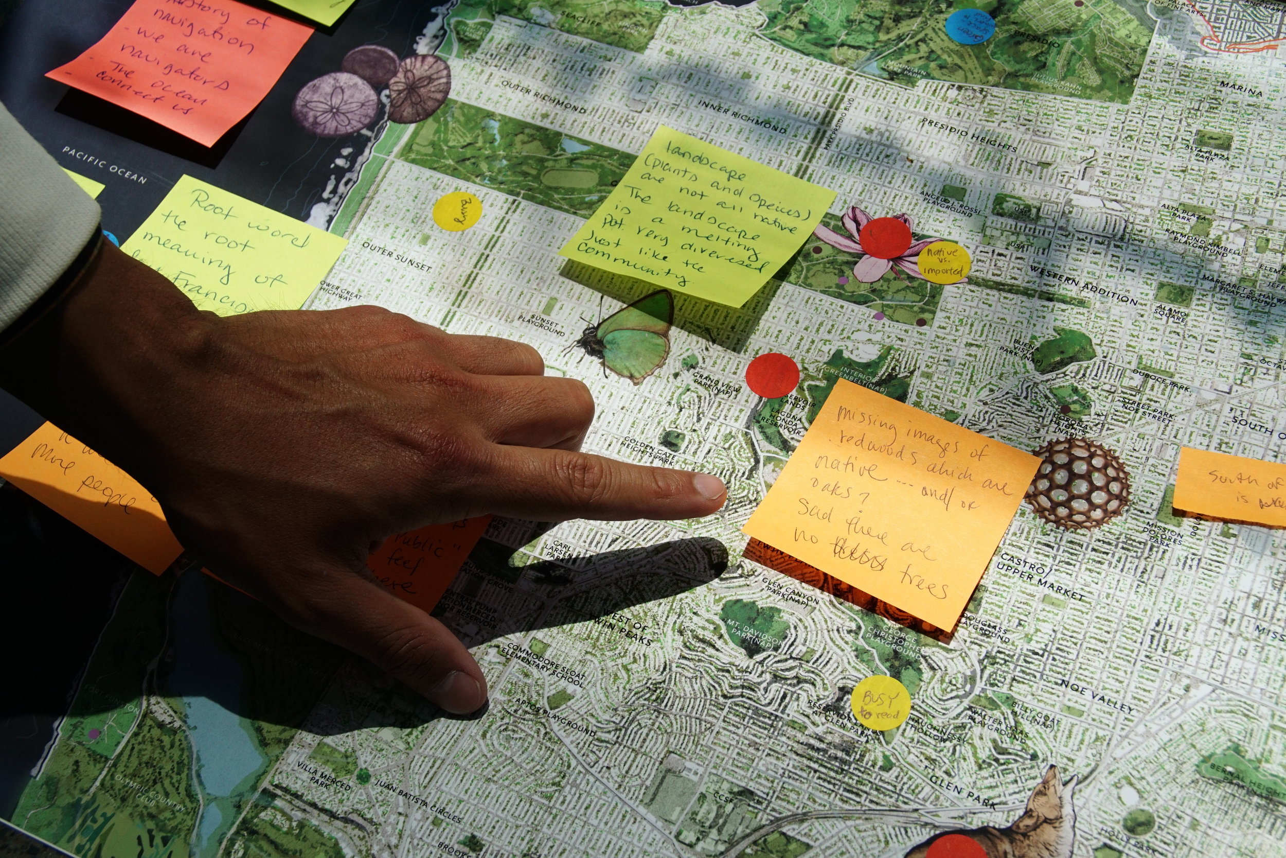
Plan, facilitate, and summarize feedback from 3 map review sessions with external stakeholders representing target audiences (90 participants, total).
Research, manage and execute pre-production cartographic tasks on geospatial datasets that were integrated into the map. Coordinate design tasks with lead artist and designer.
Map Feedback Sessions with Stakeholders


Nature serve + bureau of land management - dashboards & executive summaries, 2017
Type: Print and PDF download research summaries.
Date: 2017
Collaborators: NatureServe (client), prepared for the Bureau of Land Management.
Description: I am working with research ecologists and climate change specialists from NatureServe, a Washington, D.C. based conservation research organization to design reports for federal governmental agencies including the Bureau of Land Management and the National Park Service.
Roles & Duties: Design & Science Communication Consultant
Creative direction, information design.
Copy writing, copyediting
Layout design for print and electronic dashboards and reports from GIS-based climate vulnerability assessments for target ecosystems.