
Bay Area Sea Level Rise and Wetland Ecosystem Change Through Time
Wading through the depths and coming up for air with prototype ideas for the MVP...Most Valuable Playas??? the SEA and the LAND
2 Central animated projections and 1 screen-based interactive (with buttons?)
Requesting feedback on:
Development platforms
Style
Visitor experience
Central Projection: Sea Level Rise: Deep-Time
Animation sequence and style mock up for Gray Area Creative Code Fellowship installation.
Shellmound map from 1909 Nelson survey. I'd like to extract the points and style them in a way that doesn't give away exact locations but will illustrate evidence of indigenous settlement along the shoreline beginning 5,000 years ago. Localities will fade into the sequence 5,000 bp and fade out at 1850. Digitization, Matthew Booker, Allen Roberts, Tribal consultant, Chuck Striplen. Need permission.
Need Feedback
Basemap style; coastline mask, elevation/shaded relief, time counter.
What data to include in the basemap; current place names and coastline.
Data sources, platform for development vs. output.
Style.
Need permission from tribal members to display sensitive shellmound data in projected sequence.
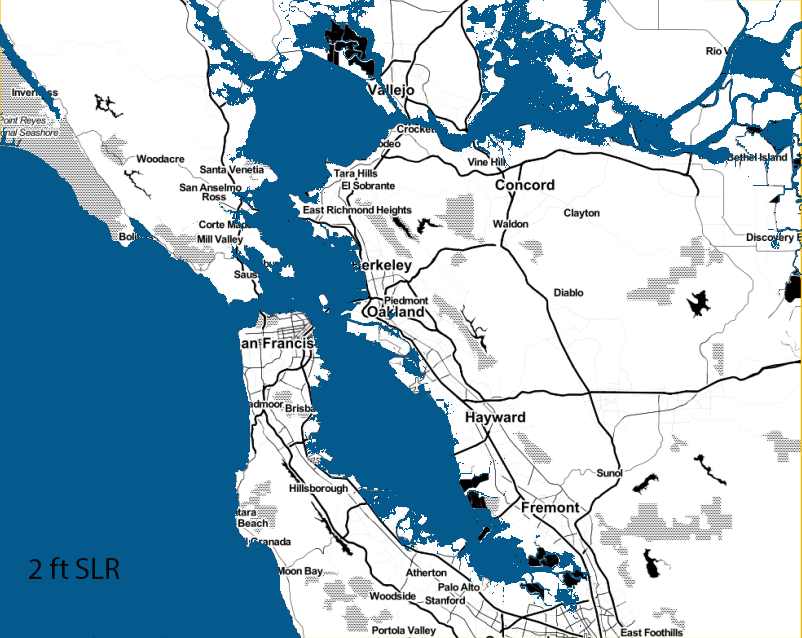
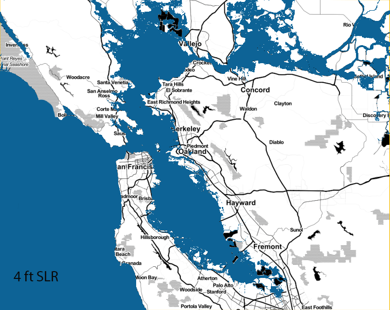
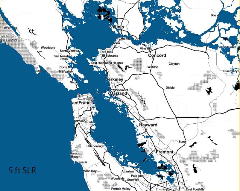
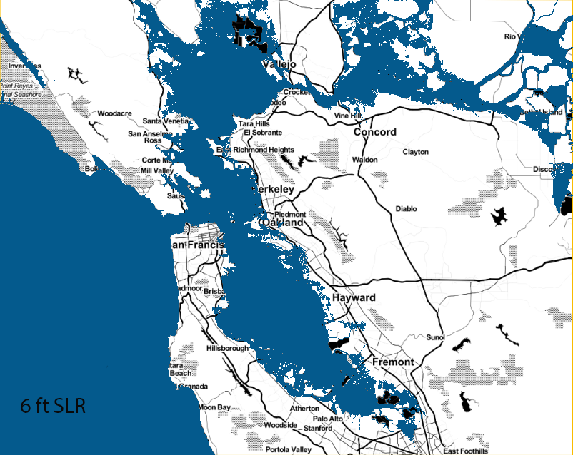
Central Projection: Sea Level Rise: Future Scenarios

Need feedback
Loading basemap tilesets into QGIS
What data to include in the basemap; transportation, rail, airports, major cities.
Data sources and style.
Interactive Screen: Wetlands of the Past and Future
Historic and present day tidal wetland extent from San Francisco Estuary Institute, EcoAtlas.org. South Bay Salt Pond Restoration Site, EcoAtlas.org represents a nuanced adaptation strategy to future sea level rise. Not sure how to represent this "adaptation" connection from present to future.
Wetland Accretion Model, 2100. Point Blue Conservation.
Soft Potentiometer (SoftPot) with Arduino and breadboard. Visitors can scrub through time directly on the screen or on a console.


Buttons Buttons......(???!)
Description
Crossfade interactive featuring wetland habitat extent of the a) past to present b) present to future.
Use a soft potentiometer (SoftPot) adhered to the screen or on a console with BUTTONS to allow visitors to select what scenario to view and to scroll through time.
Use Javascript JQuery library to build the crossfade. Need to add another crossfade frame to represent the future scenario.
Need to test with Arduino.
Files are vector and raster. Having style and projection issues. Basemap style considerations.